Lukač geodata
Lukač (Virovitičk-Podravska) is a seat of a second-order administrative division; located in Croatia in Europe/Zagreb (GMT+2) time zone. In our database, there are 904 cities with bigger population. Compared to other cities in Croatia, 75.6% of cities are located further ↓South; 74.6% of cities are located further ←West and 58.3% of cities have higher elevation than Lukač. Note1


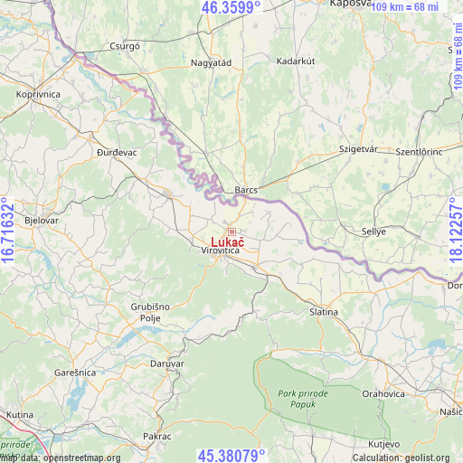
Lukač GPS coordinates[2]
45° 52' 21" North, 17° 25' 9.984" East
| Map corner | latitude | longitude |
|---|---|---|
| Upper-left | 46.3599°, | 16.71632° |
| Center: | 45.8725°, | 17.41944° |
| Lower-right: | 45.38079°, | 18.12257° |
| Map W x H: | 108.9×108.9 km | = 67.7×67.7mi |
| max Lat: | 46.52694° ⇑24.4% North |
| Lukač: | 45.8725° |
| min Lat: | ⇓75.6% South 42.54972° |
| min Long | Lukač | max Long |
| 13.52389° | 17.41944° | 19.37694° |
| W 74.6%⇐ | ⇒25.4% E |
Elevation
Elevation of Lukač is 112 m = 367 ft, and this is 41.3 m = 135 ft below average elevation for this country.
| Max E: |
827 m = 2713 ft | 58.3% |
| Avg. | 153.3 m = 503 ft | |
| Lukač | 112 m = 367 ft | |
Min E: |
-1 m = -3 ft | 41.7% |
See also: Croatia elevation on elevation.city.
Geographical zone
Lukač is located in North temperate zone (between Tropic of Cancer and the Arctic Circle). Distance of this North polar circle is 2300.6 km =1429.5 mi to North.| Distance of | km | miles | from Lukač |
|---|---|---|---|
| North Pole | 4906.5 | 3048.8 | to North |
| Arctic Circle | 2300.6 | 1429.5 | to North |
| Tropic Cancer | 2494.6 | 1550.1 | to South |
| Equator | 5100.5 | 3169.3 | to South |


Nearby cities:
15 places around Lukač: (largest is in red/bold)
• Borova
10.1 km =6.3 mi,  161°
161°
• Bušetina
5.6 km =3.5 mi,  298°
298°
• Cabuna
18 km =11.2 mi,  137°
137°
• Dugo Selo Lukačko
2.6 km =1.6 mi,  112°
112°
• Gradina
7.1 km =4.4 mi, 105°
• Otrovanec
17.4 km =10.8 mi,  288°
288°
• Pitomača
17.1 km =10.6 mi, 300°
• Rezovac
9.9 km =6.2 mi,  181°
181°
• Stari Gradac
11.5 km =7.1 mi, 300°
• Suhopolje
10.2 km =6.3 mi, 142°
• Turanovac
3 km =1.9 mi,  321°
321°
• Velika Črešnjevica
18.9 km =11.7 mi,  281°
281°
• Virovitica
5.3 km =3.3 mi,  211°
211°
• Vukosavljevica
14.5 km =9 mi,  272°
272°
• Špišić-Bukovica
9.4 km =5.8 mi,  259°
259°
Sources, notices
• [Note1] Compared only with cities in Croatia existing in our database
• [Src1] Map data: © OpenStreetMap contributors (CC-BY-SA)
• [Src2] Other city data from geonames.org with taken over terms of usage.
• [Src3] Geographical zone / Annual Mean Temperature by Robert A. Rohde @ Wikipedia
