Bartolovec geodata
Bartolovec (Varaždinska) is a populated place; located in Croatia in Europe/Zagreb (GMT+2) time zone. With population of 749 people, there are 630 cities with bigger population in this country. Compared to other cities in Croatia, 93.1% of cities are located further ↓South; 50.6% of cities are located further →East and 67.4% of cities have lower elevation than Bartolovec. Note1


Bartolovec GPS coordinates[2]
46° 17' 53.016" North, 16° 26' 27.996" East
| Map corner | latitude | longitude |
|---|---|---|
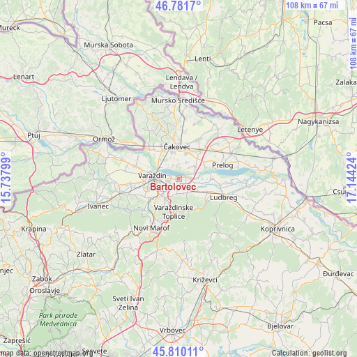
| Upper-left | 46.7817°, | 15.73799° |
| Center: | 46.29806°, | 16.44111° |
| Lower-right: | 45.81011°, | 17.14424° |
| Map W x H: | 108×108 km | = 67.1×67.1mi |
| max Lat: | 46.52694° ⇑6.9% North |
| Bartolovec: | 46.29806° |
| min Lat: | ⇓93.1% South 42.54972° |
| min Long | Bartolovec | max Long |
| 13.52389° | 16.44111° | 19.37694° |
| W 49.4%⇐ | ⇒50.6% E |
Elevation
Elevation of Bartolovec is 160 m = 525 ft, and this is 6.7 m = 22 ft above average elevation for this country.
| Max E: |
827 m = 2713 ft | 32.6% |
| Bartolovec | 160 m 525 ft | |
| Avg. | 153.3 m = 503 ft | |
Min E: |
-1 m = -3 ft | 67.4% |
See also: Croatia elevation on elevation.city.
Geographical zone
Bartolovec is located in North temperate zone (between Tropic of Cancer and the Arctic Circle). Distance of this North polar circle is 2253.3 km =1400.1 mi to North.| Distance of | km | miles | from Bartolovec |
|---|---|---|---|
| North Pole | 4859.2 | 3019.4 | to North |
| Arctic Circle | 2253.3 | 1400.1 | to North |
| Tropic Cancer | 2541.9 | 1579.5 | to South |
| Equator | 5147.9 | 3198.8 | to South |


Nearby cities:
15 places around Bartolovec: (largest is in red/bold)
• Donji Kneginec
6.1 km =3.8 mi,  225°
225°
• Donji Kućan
4.2 km =2.6 mi,  241°
241°
• Gornji Kneginec
7.3 km =4.5 mi,  223°
223°
• Jalžabet
4.9 km =3 mi,  147°
147°
• Kelemen
4.6 km =2.9 mi,  185°
185°
• Kuršanec
4.7 km =2.9 mi,  319°
319°
• Kućan Marof
5.4 km =3.4 mi,  259°
259°
• Novo Selo na Dravi
3.7 km =2.3 mi,  349°
349°
• Orehovica
6.3 km =3.9 mi,  53°
53°
• Totovec
4.7 km =2.9 mi,  1°
1°
• Trnovec Bartolovečki
3.3 km =2.1 mi, 263°
• Turčin
7.6 km =4.7 mi, 235°
• Vrbanovec
7.1 km =4.4 mi,  121°
121°
• Zbelava
2.9 km =1.8 mi, 238°
• Šemovec
2.4 km =1.5 mi,  74°
74°
Sources, notices
• [Note1] Compared only with cities in Croatia existing in our database
• [Src1] Map data: © OpenStreetMap contributors (CC-BY-SA)
• [Src2] Other city data from geonames.org with taken over terms of usage.
• [Src3] Geographical zone / Annual Mean Temperature by Robert A. Rohde @ Wikipedia
