Gornje Jesenje geodata
Gornje Jesenje (Krapinsko-Zagorska) is a seat of a second-order administrative division; located in Croatia in Europe/Zagreb (GMT+2) time zone. In our database, there are 904 cities with bigger population. Compared to other cities in Croatia, 88.7% of cities are located further ↓South; 71.3% of cities are located further →East and 93.2% of cities have lower elevation than Gornje Jesenje. Note1


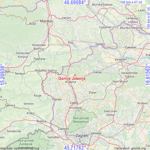
Gornje Jesenje GPS coordinates[2]
46° 12' 23.004" North, 15° 54' 45" East
| Map corner | latitude | longitude |
|---|---|---|
| Upper-left | 46.69084°, | 15.20938° |
| Center: | 46.20639°, | 15.9125° |
| Lower-right: | 45.71763°, | 16.61563° |
| Map W x H: | 108.2×108.2 km | = 67.2×67.2mi |
| max Lat: | 46.52694° ⇑11.3% North |
| Gornje Jesenje: | 46.20639° |
| min Lat: | ⇓88.7% South 42.54972° |
| min Long | Gornje Jesenje | max Long |
| 13.52389° | 15.9125° | 19.37694° |
| W 28.7%⇐ | ⇒71.3% E |
Elevation
Elevation of Gornje Jesenje is 347 m = 1138 ft, and this is 193.7 m = 635 ft above average elevation for this country.
| Max E: |
827 m = 2713 ft | 6.8% |
| Gornje Jesenje | 347 m 1138 ft | |
| Avg. | 153.3 m = 503 ft | |
Min E: |
-1 m = -3 ft | 93.2% |
See also: Croatia elevation on elevation.city.
Geographical zone
Gornje Jesenje is located in North temperate zone (between Tropic of Cancer and the Arctic Circle). Distance of this North polar circle is 2263.5 km =1406.5 mi to North.| Distance of | km | miles | from Gornje Jesenje |
|---|---|---|---|
| North Pole | 4869.4 | 3025.7 | to North |
| Arctic Circle | 2263.5 | 1406.5 | to North |
| Tropic Cancer | 2531.7 | 1573.1 | to South |
| Equator | 5137.7 | 3192.4 | to South |


Nearby cities:
15 places around Gornje Jesenje: (largest is in red/bold)
• Bedenec
12.8 km =8 mi,  72°
72°
• Bednja
6 km =3.7 mi,  63°
63°
• Donja Pačetina
13 km =8.1 mi,  190°
190°
• Krapina
5.7 km =3.5 mi,  207°
207°
• Lepoglava
9.5 km =5.9 mi,  87°
87°
• Lobor
13 km =8.1 mi,  119°
119°
• Mihovljan
9.4 km =5.8 mi,  150°
150°
• Novi Golubovec
6.5 km =4 mi,  125°
125°
• Petrovsko
7 km =4.3 mi,  232°
232°
• Radoboj
4.5 km =2.8 mi,  169°
169°
• Velika Ves
9 km =5.6 mi, 189°
• Ðurmanec
5.6 km =3.5 mi,  258°
258°
• Škarićevo
10.2 km =6.3 mi, 208°
• Žarovnica
11 km =6.8 mi, 60°
• Žarovnica
11.7 km =7.3 mi, 72°
Sources, notices
• [Note1] Compared only with cities in Croatia existing in our database
• [Src1] Map data: © OpenStreetMap contributors (CC-BY-SA)
• [Src2] Other city data from geonames.org with taken over terms of usage.
• [Src3] Geographical zone / Annual Mean Temperature by Robert A. Rohde @ Wikipedia
