Duboševica geodata
Duboševica (Osječko-Baranjska) is a populated place; located in Croatia in Europe/Zagreb (GMT+2) time zone. With population of 554 people, there are 805 cities with bigger population in this country. Compared to other cities in Croatia, 76.8% of cities are located further ↓South; 94% of cities are located further ←West and 77.6% of cities have higher elevation than Duboševica. Note1


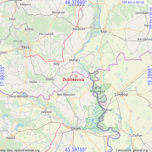
Duboševica GPS coordinates[2]
45° 53' 21.984" North, 18° 41' 48.012" East
| Map corner | latitude | longitude |
|---|---|---|
| Upper-left | 46.37669°, | 17.99355° |
| Center: | 45.88944°, | 18.69667° |
| Lower-right: | 45.39788°, | 19.3998° |
| Map W x H: | 108.8×108.8 km | = 67.6×67.6mi |
| max Lat: | 46.52694° ⇑23.2% North |
| Duboševica: | 45.88944° |
| min Lat: | ⇓76.8% South 42.54972° |
| min Long | Duboševica | max Long |
| 13.52389° | 18.69667° | 19.37694° |
| W 94%⇐ | ⇒6% E |
Elevation
Elevation of Duboševica is 87 m = 285 ft, and this is 66.3 m = 218 ft below average elevation for this country.
| Max E: |
827 m = 2713 ft | 77.6% |
| Avg. | 153.3 m = 503 ft | |
| Duboševica | 87 m = 285 ft | |
Min E: |
-1 m = -3 ft | 22.4% |
See also: Croatia elevation on elevation.city.
Geographical zone
Duboševica is located in North temperate zone (between Tropic of Cancer and the Arctic Circle). Distance of this North polar circle is 2298.7 km =1428.3 mi to North.| Distance of | km | miles | from Duboševica |
|---|---|---|---|
| North Pole | 4904.6 | 3047.6 | to North |
| Arctic Circle | 2298.7 | 1428.3 | to North |
| Tropic Cancer | 2496.5 | 1551.3 | to South |
| Equator | 5102.4 | 3170.5 | to South |


Nearby cities:
15 places around Duboševica: (largest is in red/bold)
• Baranjsko Petrovo Selo
23 km =14.3 mi,  229°
229°
• Batina
12.8 km =8 mi,  112°
112°
• Beli Manastir
15.1 km =9.4 mi,  208°
208°
• Branjin Vrh
12.4 km =7.7 mi, 212°
• Draž
8.8 km =5.5 mi,  126°
126°
• Grabovac
21.6 km =13.4 mi,  171°
171°
• Karanac
14.4 km =8.9 mi,  183°
183°
• Kneževi Vinogradi
15.7 km =9.8 mi, 169°
• Kneževo
6.4 km =4 mi,  220°
220°
• Kozarac
19 km =11.8 mi, 184°
• Petlovac
19.6 km =12.2 mi, 221°
• Popovac
9.4 km =5.8 mi,  198°
198°
• Suza
13.3 km =8.3 mi,  152°
152°
• Zmajevac
13 km =8.1 mi,  138°
138°
• Čeminac
22.7 km =14.1 mi,  185°
185°
Sources, notices
• [Note1] Compared only with cities in Croatia existing in our database
• [Src1] Map data: © OpenStreetMap contributors (CC-BY-SA)
• [Src2] Other city data from geonames.org with taken over terms of usage.
• [Src3] Geographical zone / Annual Mean Temperature by Robert A. Rohde @ Wikipedia
