Stanići geodata
Stanići (Split-Dalmatia) is a populated place; located in Croatia in Europe/Zagreb (GMT+2) time zone. With population of 534 people, there are 838 cities with bigger population in this country. Compared to other cities in Croatia, 93.8% of cities are located further ↑North; 61% of cities are located further ←West and 86.9% of cities have higher elevation than Stanići. Note1


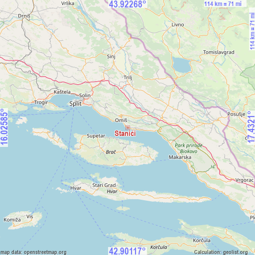
Stanići GPS coordinates[2]
43° 24' 50.688" North, 16° 43' 44.292" East
| Map corner | latitude | longitude |
|---|---|---|
| Upper-left | 43.92268°, | 16.02585° |
| Center: | 43.41408°, | 16.72897° |
| Lower-right: | 42.90117°, | 17.4321° |
| Map W x H: | 113.6×113.6 km | = 70.6×70.6mi |
| max Lat: | 46.52694° ⇑93.8% North |
| Stanići: | 43.41408° |
| min Lat: | ⇓6.2% South 42.54972° |
| min Long | Stanići | max Long |
| 13.52389° | 16.72897° | 19.37694° |
| W 61%⇐ | ⇒39% E |
Elevation
Elevation of Stanići is 50 m = 164 ft, and this is 103.3 m = 339 ft below average elevation for this country.
| Max E: |
827 m = 2713 ft | 86.9% |
| Avg. | 153.3 m = 503 ft | |
| Stanići | 50 m = 164 ft | |
Min E: |
-1 m = -3 ft | 13.1% |
See also: Croatia elevation on elevation.city.
Geographical zone
Stanići is located in North temperate zone (between Tropic of Cancer and the Arctic Circle). Distance of this Northern Tropic circle is 2221.3 km =1380.3 mi to South.| Distance of | km | miles | from Stanići |
|---|---|---|---|
| North Pole | 5179.9 | 3218.6 | to North |
| Arctic Circle | 2574 | 1599.4 | to North |
| Tropic Cancer | 2221.3 | 1380.3 | to South |
| Equator | 4827.2 | 2999.5 | to South |


Nearby cities:
15 places around Stanići: (largest is in red/bold)
• Dugi Rat
8 km =5 mi,  296°
296°
• Duće
5.8 km =3.6 mi, 303°
• Gata
6.3 km =3.9 mi,  338°
338°
• Jesenice
11.5 km =7.1 mi, 297°
• Katuni
14.7 km =9.1 mi,  67°
67°
• Kostanje
8.9 km =5.5 mi, 70°
• Kučiće
6.1 km =3.8 mi, 69°
• Nerežišće
15.3 km =9.5 mi,  232°
232°
• Omiš
4.7 km =2.9 mi,  316°
316°
• Postira
9 km =5.6 mi,  241°
241°
• Pučišća
7.4 km =4.6 mi,  176°
176°
• Srinjine
12.9 km =8 mi,  306°
306°
• Supetar
14.8 km =9.2 mi,  256°
256°
• Tugare
7.7 km =4.8 mi, 319°
• Zadvarje
13.1 km =8.1 mi,  81°
81°
Sources, notices
• [Note1] Compared only with cities in Croatia existing in our database
• [Src1] Map data: © OpenStreetMap contributors (CC-BY-SA)
• [Src2] Other city data from geonames.org with taken over terms of usage.
• [Src3] Geographical zone / Annual Mean Temperature by Robert A. Rohde @ Wikipedia
