Arcahaie geodata
Arcahaie (Nord-Ouest) is a populated place; located in Haiti in America/Port-au-Prince (GMT-4) time zone. With population of 4,119 people, there are 50 cities with bigger population in this country. Compared to other cities in Haiti, 95.3% of cities are located further ↓South; 67% of cities are located further →East and 75.5% of cities have lower elevation than Arcahaie. Note1


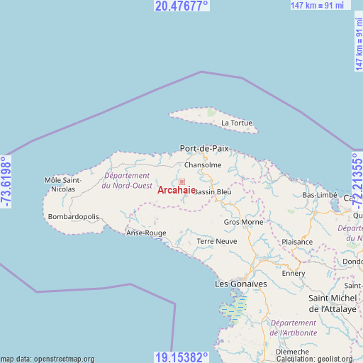
Arcahaie GPS coordinates[2]
19° 49' 0.012" North, 72° 55' 0.012" West
| Map corner | latitude | longitude |
|---|---|---|
| Upper-left | 20.47677°, | -73.6198° |
| Center: | 19.81667°, | -72.91667° |
| Lower-right: | 19.15382°, | -72.21355° |
| Map W x H: | 147.1×147.1 km | = 91.4×91.4mi |
| max Lat: | 19.93984° ⇑4.7% North |
| Arcahaie: | 19.81667° |
| min Lat: | ⇓95.3% South 18.05° |
| min Long | Arcahaie | max Long |
| -74.4528° | -72.91667° | -71.72475° |
| W 33%⇐ | ⇒67% E |
Elevation
Elevation of Arcahaie is 189 m = 620 ft, and this is 43.9 m = 144 ft above average elevation for this country.
| Max E: |
1466 m = 4810 ft | 24.5% |
| Arcahaie | 189 m 620 ft | |
| Avg. | 145.1 m = 476 ft | |
Min E: |
3 m = 10 ft | 75.5% |
See also: Haiti elevation on elevation.city.
Geographical zone
Arcahaie is located in North Torrid zone (between Equator and Tropic of Cancer). Distance of this Northern Tropic circle is 402.5 km =250.1 mi to North.| Distance of | km | miles | from Arcahaie |
|---|---|---|---|
| North Pole | 7803.7 | 4849 | to North |
| Arctic Circle | 5197.8 | 3229.8 | to North |
| Tropic Cancer | 402.5 | 250.1 | to North |
| Equator | 2203.4 | 1369.1 | to South |


Nearby cities:
15 places around Arcahaie: (largest is in red/bold)
• Anse Rouge
25 km =15.5 mi,  215°
215°
• Baie de Henne
35.1 km =21.8 mi,  240°
240°
• Bombardopolis
46.2 km =28.7 mi,  252°
252°
• Borgne
41.2 km =25.6 mi,  85°
85°
• Fond Bassin Bleu
12.5 km =7.8 mi,  101°
101°
• Gonaïves
47.5 km =29.5 mi,  149°
149°
• Gros Morne
29.8 km =18.5 mi,  123°
123°
• Jean-Rabel
29 km =18 mi,  278°
278°
• Môle Saint-Nicolas
48.1 km =29.9 mi,  268°
268°
• Petite Anse
32.4 km =20.1 mi,  230°
230°
• Pilate
41.6 km =25.8 mi,  113°
113°
• Port-de-Paix
16.4 km =10.2 mi,  33°
33°
• Saint-Louis du Nord
24.2 km =15 mi,  57°
57°
• Terre Neuve
28 km =17.4 mi, 149°
• Ti Port-de-Paix
15.6 km =9.7 mi, 33°
Sources, notices
• [Note1] Compared only with cities in Haiti existing in our database
• [Src1] Map data: © OpenStreetMap contributors (CC-BY-SA)
• [Src2] Other city data from geonames.org with taken over terms of usage.
• [Src3] Geographical zone / Annual Mean Temperature by Robert A. Rohde @ Wikipedia
