Nagytarcsa geodata
Nagytarcsa (Pest) is a populated place; located in Hungary in Europe/Budapest (GMT+2) time zone. With population of 2,846 people, there are 527 cities with bigger population in this country. Compared to other cities in Hungary, 58.2% of cities are located further ↓South; 54.8% of cities are located further →East and 86.4% of cities have lower elevation than Nagytarcsa. Note1


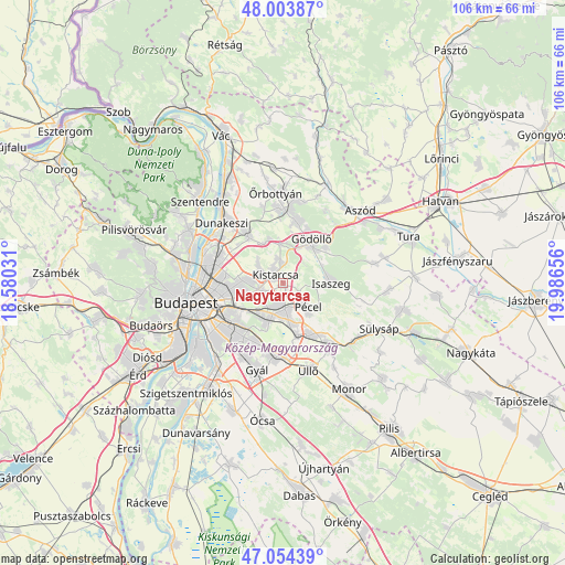
Nagytarcsa GPS coordinates[2]
47° 31' 52.608" North, 19° 17' 0.348" East
| Map corner | latitude | longitude |
|---|---|---|
| Upper-left | 48.00387°, | 18.58031° |
| Center: | 47.53128°, | 19.28343° |
| Lower-right: | 47.05439°, | 19.98656° |
| Map W x H: | 105.6×105.6 km | = 65.6×65.6mi |
| max Lat: | 48.46667° ⇑41.8% North |
| Nagytarcsa: | 47.53128° |
| min Lat: | ⇓58.2% South 45.79108° |
| min Long | Nagytarcsa | max Long |
| 16.27358° | 19.28343° | 22.68096° |
| W 45.2%⇐ | ⇒54.8% E |
Elevation
Elevation of Nagytarcsa is 176 m = 577 ft, and this is 46.3 m = 152 ft above average elevation for this country.
| Max E: |
444 m = 1457 ft | 13.6% |
| Nagytarcsa | 176 m 577 ft | |
| Avg. | 129.7 m = 426 ft | |
Min E: |
71 m = 233 ft | 86.4% |
See also: Hungary elevation on elevation.city.
Geographical zone
Nagytarcsa is located in North temperate zone (between Tropic of Cancer and the Arctic Circle). Distance of this North polar circle is 2116.2 km =1314.9 mi to North.| Distance of | km | miles | from Nagytarcsa |
|---|---|---|---|
| North Pole | 4722.1 | 2934.2 | to North |
| Arctic Circle | 2116.2 | 1314.9 | to North |
| Tropic Cancer | 2679.1 | 1664.7 | to South |
| Equator | 5285 | 3283.9 | to South |


Nearby cities:
15 places around Nagytarcsa: (largest is in red/bold)
• Budapest X. kerület
11 km =6.8 mi,  238°
238°
• Budapest XVI. kerület
8.7 km =5.4 mi,  257°
257°
• Budapest XVII. kerület
6.1 km =3.8 mi,  201°
201°
• Budapest XVIII. kerület
12.6 km =7.8 mi,  219°
219°
• Csömör
4.3 km =2.7 mi,  298°
298°
• Ecser
10.2 km =6.3 mi,  162°
162°
• Fót
12 km =7.5 mi,  323°
323°
• Gödöllő
9 km =5.6 mi,  36°
36°
• Isaszeg
8.9 km =5.5 mi,  90°
90°
• Kerepes
3.2 km =2 mi,  359°
359°
• Kistarcsa
2.4 km =1.5 mi, 319°
• Maglód
11.6 km =7.2 mi,  148°
148°
• Mogyoród
8 km =5 mi,  336°
336°
• Pécel
6.4 km =4 mi,  136°
136°
• Szada
11.6 km =7.2 mi,  12°
12°
Sources, notices
• [Note1] Compared only with cities in Hungary existing in our database
• [Src1] Map data: © OpenStreetMap contributors (CC-BY-SA)
• [Src2] Other city data from geonames.org with taken over terms of usage.
• [Src3] Geographical zone / Annual Mean Temperature by Robert A. Rohde @ Wikipedia
