Lébény geodata
Lébény (Győr-Moson-Sopron) is a populated place; located in Hungary in Europe/Budapest (GMT+2) time zone. With population of 3,221 people, there are 458 cities with bigger population in this country. Compared to other cities in Hungary, 73.6% of cities are located further ↓South; 92.8% of cities are located further →East and 52.5% of cities have lower elevation than Lébény. Note1


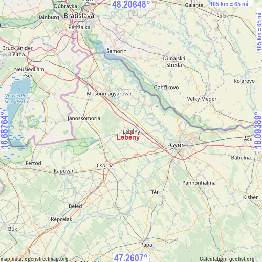
Lébény GPS coordinates[2]
47° 44' 8.664" North, 17° 23' 26.736" East
| Map corner | latitude | longitude |
|---|---|---|
| Upper-left | 48.20648°, | 16.68764° |
| Center: | 47.73574°, | 17.39076° |
| Lower-right: | 47.2607°, | 18.09389° |
| Map W x H: | 105.2×105.2 km | = 65.4×65.4mi |
| max Lat: | 48.46667° ⇑26.4% North |
| Lébény: | 47.73574° |
| min Lat: | ⇓73.6% South 45.79108° |
| min Long | Lébény | max Long |
| 16.27358° | 17.39076° | 22.68096° |
| W 7.2%⇐ | ⇒92.8% E |
Elevation
Elevation of Lébény is 118 m = 387 ft, and this is 11.7 m = 38 ft below average elevation for this country.
| Max E: |
444 m = 1457 ft | 47.5% |
| Avg. | 129.7 m = 426 ft | |
| Lébény | 118 m = 387 ft | |
Min E: |
71 m = 233 ft | 52.5% |
See also: Hungary elevation on elevation.city.
Geographical zone
Lébény is located in North temperate zone (between Tropic of Cancer and the Arctic Circle). Distance of this North polar circle is 2093.5 km =1300.8 mi to North.| Distance of | km | miles | from Lébény |
|---|---|---|---|
| North Pole | 4699.3 | 2920 | to North |
| Arctic Circle | 2093.5 | 1300.8 | to North |
| Tropic Cancer | 2701.8 | 1678.8 | to South |
| Equator | 5307.7 | 3298.1 | to South |


Nearby cities:
15 places around Lébény: (largest is in red/bold)
• Abda
12.4 km =7.7 mi,  111°
111°
• Bősárkány
11.8 km =7.3 mi,  243°
243°
• Csorna
17.4 km =10.8 mi,  217°
217°
• Győr
19.2 km =11.9 mi, 107°
• Halászi
17.7 km =11 mi,  344°
344°
• Jánossomorja
19.8 km =12.3 mi,  286°
286°
• Kimle
9.2 km =5.7 mi,  348°
348°
• Kóny
12 km =7.5 mi,  192°
192°
• Mosonmagyaróvár
17.2 km =10.7 mi,  328°
328°
• Mosonszentmiklós
2.9 km =1.8 mi, 107°
• Rábacsécsény
16.8 km =10.4 mi,  171°
171°
• Rábapatona
13.3 km =8.3 mi,  149°
149°
• Rábaszentmihály
17.9 km =11.1 mi, 169°
• Ásványráró
12.8 km =8 mi,  37°
37°
• Öttevény
7.3 km =4.5 mi,  104°
104°
Sources, notices
• [Note1] Compared only with cities in Hungary existing in our database
• [Src1] Map data: © OpenStreetMap contributors (CC-BY-SA)
• [Src2] Other city data from geonames.org with taken over terms of usage.
• [Src3] Geographical zone / Annual Mean Temperature by Robert A. Rohde @ Wikipedia
