Kerekegyháza geodata
Kerekegyháza (Bács-Kiskun) is a populated place; located in Hungary in Europe/Budapest (GMT+2) time zone. With population of 5,983 people, there are 256 cities with bigger population in this country. Compared to other cities in Hungary, 71.3% of cities are located further ↑North; 50.8% of cities are located further →East and 52.5% of cities have lower elevation than Kerekegyháza. Note1


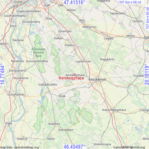
Kerekegyháza GPS coordinates[2]
46° 56' 13.992" North, 19° 28' 41.016" East
| Map corner | latitude | longitude |
|---|---|---|
| Upper-left | 47.41516°, | 18.77494° |
| Center: | 46.93722°, | 19.47806° |
| Lower-right: | 46.45497°, | 20.18119° |
| Map W x H: | 106.8×106.8 km | = 66.4×66.4mi |
| max Lat: | 48.46667° ⇑71.3% North |
| Kerekegyháza: | 46.93722° |
| min Lat: | ⇓28.7% South 45.79108° |
| min Long | Kerekegyháza | max Long |
| 16.27358° | 19.47806° | 22.68096° |
| W 49.2%⇐ | ⇒50.8% E |
Elevation
Elevation of Kerekegyháza is 118 m = 387 ft, and this is 11.7 m = 38 ft below average elevation for this country.
| Max E: |
444 m = 1457 ft | 47.5% |
| Avg. | 129.7 m = 426 ft | |
| Kerekegyháza | 118 m = 387 ft | |
Min E: |
71 m = 233 ft | 52.5% |
See also: Hungary elevation on elevation.city.
Geographical zone
Kerekegyháza is located in North temperate zone (between Tropic of Cancer and the Arctic Circle). Distance of this North polar circle is 2182.2 km =1356 mi to North.| Distance of | km | miles | from Kerekegyháza |
|---|---|---|---|
| North Pole | 4788.1 | 2975.2 | to North |
| Arctic Circle | 2182.2 | 1356 | to North |
| Tropic Cancer | 2613 | 1623.6 | to South |
| Equator | 5218.9 | 3242.9 | to South |


Nearby cities:
15 places around Kerekegyháza: (largest is in red/bold)
• Ballószög
10.9 km =6.8 mi,  139°
139°
• Csemő
25.8 km =16 mi,  38°
38°
• Fülöpszállás
22.4 km =13.9 mi,  234°
234°
• Helvécia
15.7 km =9.8 mi, 135°
• Hernád
25.3 km =15.7 mi,  352°
352°
• Izsák
17.6 km =10.9 mi,  213°
213°
• Kecskemét
16.6 km =10.3 mi,  102°
102°
• Lajosmizse
11.3 km =7 mi,  34°
34°
• Nagykőrös
25.2 km =15.7 mi,  64°
64°
• Orgovány
20.7 km =12.9 mi,  181°
181°
• Szabadszállás
20.5 km =12.7 mi,  250°
250°
• Táborfalva
18 km =11.2 mi,  0°
0°
• Városföld
25.1 km =15.6 mi,  122°
122°
• Ágasegyháza
11 km =6.8 mi,  190°
190°
• Örkény
21.7 km =13.5 mi, 350°
Sources, notices
• [Note1] Compared only with cities in Hungary existing in our database
• [Src1] Map data: © OpenStreetMap contributors (CC-BY-SA)
• [Src2] Other city data from geonames.org with taken over terms of usage.
• [Src3] Geographical zone / Annual Mean Temperature by Robert A. Rohde @ Wikipedia
