Gyál geodata
Gyál (Pest) is a seat of a second-order administrative division; located in Hungary in Europe/Budapest (GMT+2) time zone. With population of 21,937 people, there are 77 cities with bigger population in this country. Compared to other cities in Hungary, 52% of cities are located further ↑North; 56.5% of cities are located further →East and 54.7% of cities have higher elevation than Gyál. Note1


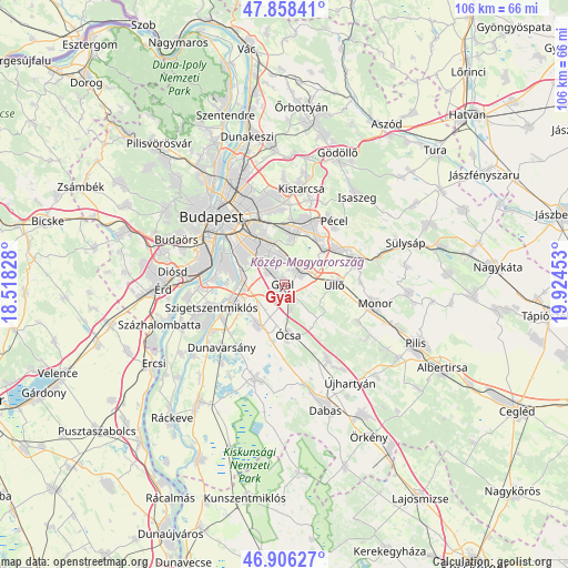
Gyál GPS coordinates[2]
47° 23' 4.164" North, 19° 13' 17.04" East
| Map corner | latitude | longitude |
|---|---|---|
| Upper-left | 47.85841°, | 18.51828° |
| Center: | 47.38449°, | 19.2214° |
| Lower-right: | 46.90627°, | 19.92453° |
| Map W x H: | 105.9×105.9 km | = 65.8×65.8mi |
| max Lat: | 48.46667° ⇑52% North |
| Gyál: | 47.38449° |
| min Lat: | ⇓48% South 45.79108° |
| min Long | Gyál | max Long |
| 16.27358° | 19.2214° | 22.68096° |
| W 43.5%⇐ | ⇒56.5% E |
Elevation
Elevation of Gyál is 113 m = 371 ft, and this is 16.7 m = 55 ft below average elevation for this country.
| Max E: |
444 m = 1457 ft | 54.7% |
| Avg. | 129.7 m = 426 ft | |
| Gyál | 113 m = 371 ft | |
Min E: |
71 m = 233 ft | 45.3% |
See also: Hungary elevation on elevation.city.
Geographical zone
Gyál is located in North temperate zone (between Tropic of Cancer and the Arctic Circle). Distance of this North polar circle is 2132.5 km =1325.1 mi to North.| Distance of | km | miles | from Gyál |
|---|---|---|---|
| North Pole | 4738.4 | 2944.3 | to North |
| Arctic Circle | 2132.5 | 1325.1 | to North |
| Tropic Cancer | 2662.7 | 1654.5 | to South |
| Equator | 5268.7 | 3273.8 | to South |


Nearby cities:
15 places around Gyál: (largest is in red/bold)
• Alsónémedi
9 km =5.6 mi,  211°
211°
• Budapest X. kerület
11.5 km =7.1 mi,  335°
335°
• Budapest XIX. kerület
9.3 km =5.8 mi,  324°
324°
• Budapest XVII. kerület
10.9 km =6.8 mi,  12°
12°
• Budapest XVIII. kerület
7.5 km =4.7 mi,  332°
332°
• Budapest XX. kerület
10.8 km =6.7 mi,  302°
302°
• Budapest XXI. kerület
12.4 km =7.7 mi,  294°
294°
• Budapest XXIII. kerület
8.2 km =5.1 mi,  280°
280°
• Dunaharaszti
9.9 km =6.2 mi,  250°
250°
• Ecser
10.2 km =6.3 mi,  49°
49°
• Felsőpakony
4.7 km =2.9 mi,  165°
165°
• Kispest
9.6 km =6 mi, 320°
• Vecsés
5.5 km =3.4 mi,  62°
62°
• Ócsa
9.4 km =5.8 mi,  175°
175°
• Üllő
10.1 km =6.3 mi,  87°
87°
Sources, notices
• [Note1] Compared only with cities in Hungary existing in our database
• [Src1] Map data: © OpenStreetMap contributors (CC-BY-SA)
• [Src2] Other city data from geonames.org with taken over terms of usage.
• [Src3] Geographical zone / Annual Mean Temperature by Robert A. Rohde @ Wikipedia
