Felsőpakony geodata
Felsőpakony (Pest) is a populated place; located in Hungary in Europe/Budapest (GMT+2) time zone. With population of 3,040 people, there are 488 cities with bigger population in this country. Compared to other cities in Hungary, 54.4% of cities are located further ↑North; 56% of cities are located further →East and 62.4% of cities have higher elevation than Felsőpakony. Note1


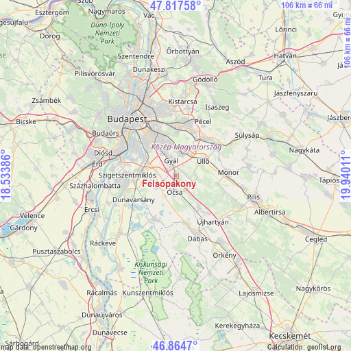
Felsőpakony GPS coordinates[2]
47° 20' 35.844" North, 19° 14' 13.128" East
| Map corner | latitude | longitude |
|---|---|---|
| Upper-left | 47.81758°, | 18.53386° |
| Center: | 47.34329°, | 19.23698° |
| Lower-right: | 46.8647°, | 19.94011° |
| Map W x H: | 106×105.9 km | = 65.9×65.8mi |
| max Lat: | 48.46667° ⇑54.4% North |
| Felsőpakony: | 47.34329° |
| min Lat: | ⇓45.6% South 45.79108° |
| min Long | Felsőpakony | max Long |
| 16.27358° | 19.23698° | 22.68096° |
| W 44%⇐ | ⇒56% E |
Elevation
Elevation of Felsőpakony is 108 m = 354 ft, and this is 21.7 m = 71 ft below average elevation for this country.
| Max E: |
444 m = 1457 ft | 62.4% |
| Avg. | 129.7 m = 426 ft | |
| Felsőpakony | 108 m = 354 ft | |
Min E: |
71 m = 233 ft | 37.6% |
See also: Hungary elevation on elevation.city.
Geographical zone
Felsőpakony is located in North temperate zone (between Tropic of Cancer and the Arctic Circle). Distance of this North polar circle is 2137.1 km =1327.9 mi to North.| Distance of | km | miles | from Felsőpakony |
|---|---|---|---|
| North Pole | 4743 | 2947.2 | to North |
| Arctic Circle | 2137.1 | 1327.9 | to North |
| Tropic Cancer | 2658.2 | 1651.7 | to South |
| Equator | 5264.1 | 3271 | to South |


Nearby cities:
15 places around Felsőpakony: (largest is in red/bold)
• Alsónémedi
6.7 km =4.2 mi,  242°
242°
• Budapest XIX. kerület
13.9 km =8.6 mi,  331°
331°
• Budapest XVIII. kerület
12.1 km =7.5 mi,  337°
337°
• Budapest XXIII. kerület
11 km =6.8 mi,  303°
303°
• Dunaharaszti
10.5 km =6.5 mi,  276°
276°
• Ecser
13 km =8.1 mi,  30°
30°
• Gyál
4.7 km =2.9 mi,  345°
345°
• Inárcs
11.3 km =7 mi,  143°
143°
• Kispest
14.1 km =8.8 mi, 328°
• Maglód
14.6 km =9.1 mi,  40°
40°
• Péteri
14.1 km =8.8 mi,  67°
67°
• Taksony
12.9 km =8 mi,  263°
263°
• Vecsés
8 km =5 mi, 27°
• Ócsa
4.9 km =3 mi,  185°
185°
• Üllő
10.2 km =6.3 mi,  61°
61°
Sources, notices
• [Note1] Compared only with cities in Hungary existing in our database
• [Src1] Map data: © OpenStreetMap contributors (CC-BY-SA)
• [Src2] Other city data from geonames.org with taken over terms of usage.
• [Src3] Geographical zone / Annual Mean Temperature by Robert A. Rohde @ Wikipedia
