Fertőszentmiklós geodata
Fertőszentmiklós (Győr-Moson-Sopron) is a populated place; located in Hungary in Europe/Budapest (GMT+2) time zone. With population of 3,877 people, there are 386 cities with bigger population in this country. Compared to other cities in Hungary, 61.5% of cities are located further ↓South; 97.5% of cities are located further →East and 60.4% of cities have lower elevation than Fertőszentmiklós. Note1


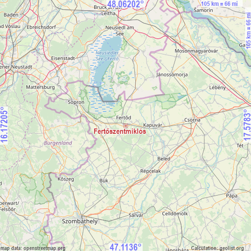
Fertőszentmiklós GPS coordinates[2]
47° 35' 23.856" North, 16° 52' 30.612" East
| Map corner | latitude | longitude |
|---|---|---|
| Upper-left | 48.06202°, | 16.17205° |
| Center: | 47.58996°, | 16.87517° |
| Lower-right: | 47.1136°, | 17.5783° |
| Map W x H: | 105.5×105.5 km | = 65.6×65.6mi |
| max Lat: | 48.46667° ⇑38.5% North |
| Fertőszentmiklós: | 47.58996° |
| min Lat: | ⇓61.5% South 45.79108° |
| min Long | Fertőszentmikl | max Long |
| 16.27358° | 16.87517° | 22.68096° |
| W 2.5%⇐ | ⇒97.5% E |
Elevation
Elevation of Fertőszentmiklós is 126 m = 413 ft, and this is 3.7 m = 12 ft below average elevation for this country.
| Max E: |
444 m = 1457 ft | 39.6% |
| Avg. | 129.7 m = 426 ft | |
| Fertőszentmiklós | 126 m = 413 ft | |
Min E: |
71 m = 233 ft | 60.4% |
See also: Hungary elevation on elevation.city.
Geographical zone
Fertőszentmiklós is located in North temperate zone (between Tropic of Cancer and the Arctic Circle). Distance of this North polar circle is 2109.7 km =1310.9 mi to North.| Distance of | km | miles | from Fertőszentmiklós |
|---|---|---|---|
| North Pole | 4715.6 | 2930.1 | to North |
| Arctic Circle | 2109.7 | 1310.9 | to North |
| Tropic Cancer | 2685.6 | 1668.8 | to South |
| Equator | 5291.5 | 3288 | to South |


Nearby cities:
15 places around Fertőszentmiklós: (largest is in red/bold)
• Beled
21.4 km =13.3 mi,  130°
130°
• Bük
24.6 km =15.3 mi,  202°
202°
• Csepreg
24.4 km =15.2 mi,  210°
210°
• Csorna
28.2 km =17.5 mi,  85°
85°
• Farád
24.4 km =15.2 mi, 85°
• Fertőd
3.5 km =2.2 mi,  354°
354°
• Fertőrákos
22.2 km =13.8 mi,  310°
310°
• Jánossomorja
29.3 km =18.2 mi,  41°
41°
• Kapuvár
11.5 km =7.1 mi, 88°
• Kisfalud
17.6 km =10.9 mi,  113°
113°
• Mihályi
18.5 km =11.5 mi,  117°
117°
• Nagycenk
13.4 km =8.3 mi,  276°
276°
• Répcelak
21.6 km =13.4 mi,  150°
150°
• Sopron
23.8 km =14.8 mi,  296°
296°
• Ágfalva
29.1 km =18.1 mi,  292°
292°
Sources, notices
• [Note1] Compared only with cities in Hungary existing in our database
• [Src1] Map data: © OpenStreetMap contributors (CC-BY-SA)
• [Src2] Other city data from geonames.org with taken over terms of usage.
• [Src3] Geographical zone / Annual Mean Temperature by Robert A. Rohde @ Wikipedia
