Nagycenk geodata
Nagycenk (Győr-Moson-Sopron) is a populated place; located in Hungary in Europe/Budapest (GMT+2) time zone. With population of 1,856 people, there are 843 cities with bigger population in this country. Compared to other cities in Hungary, 62.9% of cities are located further ↓South; 98.7% of cities are located further →East and 81% of cities have lower elevation than Nagycenk. Note1


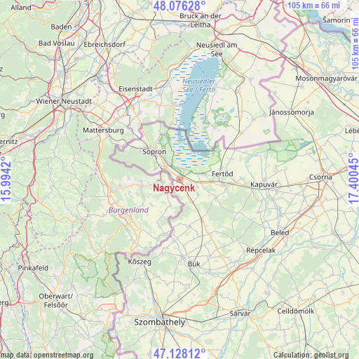
Nagycenk GPS coordinates[2]
47° 36' 15.66" North, 16° 41' 50.352" East
| Map corner | latitude | longitude |
|---|---|---|
| Upper-left | 48.07628°, | 15.9942° |
| Center: | 47.60435°, | 16.69732° |
| Lower-right: | 47.12812°, | 17.40045° |
| Map W x H: | 105.4×105.4 km | = 65.5×65.5mi |
| max Lat: | 48.46667° ⇑37.1% North |
| Nagycenk: | 47.60435° |
| min Lat: | ⇓62.9% South 45.79108° |
| min Long | Nagycenk | max Long |
| 16.27358° | 16.69732° | 22.68096° |
| W 1.3%⇐ | ⇒98.7% E |
Elevation
Elevation of Nagycenk is 159 m = 522 ft, and this is 29.3 m = 96 ft above average elevation for this country.
| Max E: |
444 m = 1457 ft | 19% |
| Nagycenk | 159 m 522 ft | |
| Avg. | 129.7 m = 426 ft | |
Min E: |
71 m = 233 ft | 81% |
See also: Hungary elevation on elevation.city.
Geographical zone
Nagycenk is located in North temperate zone (between Tropic of Cancer and the Arctic Circle). Distance of this North polar circle is 2108.1 km =1309.9 mi to North.| Distance of | km | miles | from Nagycenk |
|---|---|---|---|
| North Pole | 4714 | 2929.1 | to North |
| Arctic Circle | 2108.1 | 1309.9 | to North |
| Tropic Cancer | 2687.2 | 1669.7 | to South |
| Equator | 5293.1 | 3289 | to South |


Nearby cities:
15 places around Nagycenk: (largest is in red/bold)
• Beled
33.4 km =20.8 mi,  117°
117°
• Bük
24.7 km =15.3 mi,  170°
170°
• Csepreg
22.6 km =14 mi,  177°
177°
• Farád
37.7 km =23.4 mi,  89°
89°
• Fertőd
13.2 km =8.2 mi,  81°
81°
• Fertőrákos
13.3 km =8.3 mi,  344°
344°
• Fertőszentmiklós
13.4 km =8.3 mi,  96°
96°
• Gencsapáti
36.3 km =22.6 mi,  192°
192°
• Kapuvár
24.9 km =15.5 mi, 93°
• Kisfalud
30.7 km =19.1 mi,  106°
106°
• Kőszeg
26.6 km =16.5 mi,  206°
206°
• Mihályi
31.5 km =19.6 mi, 108°
• Répcelak
31.5 km =19.6 mi,  130°
130°
• Sopron
12 km =7.5 mi,  318°
318°
• Ágfalva
16.5 km =10.3 mi,  305°
305°
Sources, notices
• [Note1] Compared only with cities in Hungary existing in our database
• [Src1] Map data: © OpenStreetMap contributors (CC-BY-SA)
• [Src2] Other city data from geonames.org with taken over terms of usage.
• [Src3] Geographical zone / Annual Mean Temperature by Robert A. Rohde @ Wikipedia
