Nagydobsza geodata
Nagydobsza (Baranya) is a populated place; located in Hungary in Europe/Budapest (GMT+2) time zone. With population of 697 people, there are 881 cities with bigger population in this country. Compared to other cities in Hungary, 98.4% of cities are located further ↑North; 89.5% of cities are located further →East and 56.8% of cities have lower elevation than Nagydobsza. Note1


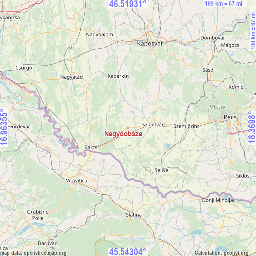
Nagydobsza GPS coordinates[2]
46° 1' 59.988" North, 17° 40' 0.012" East
| Map corner | latitude | longitude |
|---|---|---|
| Upper-left | 46.51931°, | 16.96355° |
| Center: | 46.03333°, | 17.66667° |
| Lower-right: | 45.54304°, | 18.3698° |
| Map W x H: | 108.6×108.6 km | = 67.5×67.5mi |
| max Lat: | 48.46667° ⇑98.4% North |
| Nagydobsza: | 46.03333° |
| min Lat: | ⇓1.6% South 45.79108° |
| min Long | Nagydobsza | max Long |
| 16.27358° | 17.66667° | 22.68096° |
| W 10.5%⇐ | ⇒89.5% E |
Elevation
Elevation of Nagydobsza is 123 m = 404 ft, and this is 6.7 m = 22 ft below average elevation for this country.
| Max E: |
444 m = 1457 ft | 43.2% |
| Avg. | 129.7 m = 426 ft | |
| Nagydobsza | 123 m = 404 ft | |
Min E: |
71 m = 233 ft | 56.8% |
See also: Hungary elevation on elevation.city.
Geographical zone
Nagydobsza is located in North temperate zone (between Tropic of Cancer and the Arctic Circle). Distance of this North polar circle is 2282.7 km =1418.4 mi to North.| Distance of | km | miles | from Nagydobsza |
|---|---|---|---|
| North Pole | 4888.6 | 3037.6 | to North |
| Arctic Circle | 2282.7 | 1418.4 | to North |
| Tropic Cancer | 2512.5 | 1561.2 | to South |
| Equator | 5118.4 | 3180.4 | to South |


Nearby cities:
15 places around Nagydobsza: (largest is in red/bold)
• Babócsa
25 km =15.5 mi,  272°
272°
• Barcs
18 km =11.2 mi,  243°
243°
• Bükkösd
26.1 km =16.2 mi,  71°
71°
• Gödre
36.7 km =22.8 mi,  39°
39°
• Kadarkút
22.8 km =14.2 mi,  350°
350°
• Kaposmérő
36.6 km =22.7 mi,  4°
4°
• Kaposvár
38.5 km =23.9 mi,  15°
15°
• Lábod
25.2 km =15.7 mi,  319°
319°
• Nagyatád
32.3 km =20.1 mi,  312°
312°
• Pellérd
37.6 km =23.4 mi,  89°
89°
• Sellye
22.7 km =14.1 mi,  142°
142°
• Szentlőrinc
24.8 km =15.4 mi, 88°
• Szigetvár
10.9 km =6.8 mi,  80°
80°
• Vajszló
31.2 km =19.4 mi,  128°
128°
• Ötvöskónyi
36.8 km =22.9 mi, 320°
Sources, notices
• [Note1] Compared only with cities in Hungary existing in our database
• [Src1] Map data: © OpenStreetMap contributors (CC-BY-SA)
• [Src2] Other city data from geonames.org with taken over terms of usage.
• [Src3] Geographical zone / Annual Mean Temperature by Robert A. Rohde @ Wikipedia
