Barcs geodata
Barcs (Somogy) is a seat of a second-order administrative division; located in Hungary in Europe/Budapest (GMT+2) time zone. With population of 12,116 people, there are 135 cities with bigger population in this country. Compared to other cities in Hungary, 99.2% of cities are located further ↑North; 91.8% of cities are located further →East and 63.9% of cities have higher elevation than Barcs. Note1


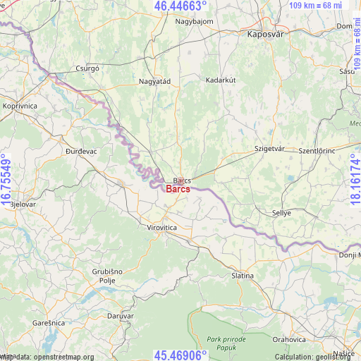
Barcs GPS coordinates[2]
45° 57' 36" North, 17° 27' 30.996" East
| Map corner | latitude | longitude |
|---|---|---|
| Upper-left | 46.44663°, | 16.75549° |
| Center: | 45.96°, | 17.45861° |
| Lower-right: | 45.46906°, | 18.16174° |
| Map W x H: | 108.7×108.7 km | = 67.5×67.5mi |
| max Lat: | 48.46667° ⇑99.2% North |
| Barcs: | 45.96° |
| min Lat: | ⇓0.8% South 45.79108° |
| min Long | Barcs | max Long |
| 16.27358° | 17.45861° | 22.68096° |
| W 8.2%⇐ | ⇒91.8% E |
Elevation
Elevation of Barcs is 107 m = 351 ft, and this is 22.7 m = 74 ft below average elevation for this country.
| Max E: |
444 m = 1457 ft | 63.9% |
| Avg. | 129.7 m = 426 ft | |
| Barcs | 107 m = 351 ft | |
Min E: |
71 m = 233 ft | 36.1% |
See also: Hungary elevation on elevation.city.
Geographical zone
Barcs is located in North temperate zone (between Tropic of Cancer and the Arctic Circle). Distance of this North polar circle is 2290.9 km =1423.5 mi to North.| Distance of | km | miles | from Barcs |
|---|---|---|---|
| North Pole | 4896.8 | 3042.7 | to North |
| Arctic Circle | 2290.9 | 1423.5 | to North |
| Tropic Cancer | 2504.4 | 1556.2 | to South |
| Equator | 5110.3 | 3175.4 | to South |


Nearby cities:
15 places around Barcs: (largest is in red/bold)
• Babócsa
12.7 km =7.9 mi,  315°
315°
• Berzence
36.6 km =22.7 mi, 319°
• Bükkösd
44 km =27.3 mi,  68°
68°
• Csurgó
42.7 km =26.5 mi, 319°
• Kadarkút
33.1 km =20.6 mi,  22°
22°
• Lábod
27.3 km =17 mi,  359°
359°
• Nagyatád
31 km =19.3 mi,  345°
345°
• Nagybajom
48.2 km =30 mi,  4°
4°
• Nagydobsza
18 km =11.2 mi,  63°
63°
• Segesd
43.2 km =26.8 mi, 348°
• Sellye
31.6 km =19.6 mi,  107°
107°
• Szentlőrinc
41.8 km =26 mi,  77°
77°
• Szigetvár
28.5 km =17.7 mi, 69°
• Vajszló
42.2 km =26.2 mi, 105°
• Ötvöskónyi
37.2 km =23.1 mi, 348°
Sources, notices
• [Note1] Compared only with cities in Hungary existing in our database
• [Src1] Map data: © OpenStreetMap contributors (CC-BY-SA)
• [Src2] Other city data from geonames.org with taken over terms of usage.
• [Src3] Geographical zone / Annual Mean Temperature by Robert A. Rohde @ Wikipedia
