Malunda geodata
Malunda (West Sulawesi) is a seat of a third-order administrative division; located in Indonesia in Asia/Makassar (GMT+8) time zone. In our database, there are 407 cities with bigger population. Compared to other cities in Indonesia, 91.2% of cities are located further ↓South; 80.5% of cities are located further ←West and 90.6% of cities have higher elevation than Malunda. Note1


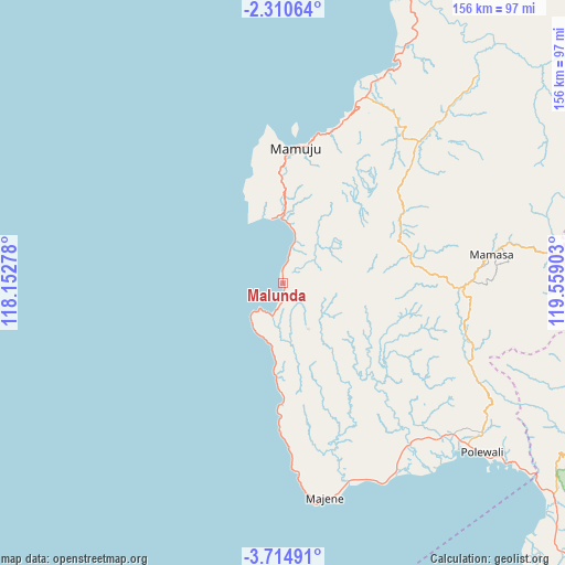
Malunda GPS coordinates[2]
3° 0' 46.8" South, 118° 51' 21.24" East
| Map corner | latitude | longitude |
|---|---|---|
| Upper-left | -2.31064°, | 118.15278° |
| Center: | -3.013°, | 118.8559° |
| Lower-right: | -3.71491°, | 119.55903° |
| Map W x H: | 156.1×156.1 km | = 97×97mi |
| max Lat: | 5.88969° ⇑8.8% North |
| Malunda: | -3.013° |
| min Lat: | ⇓91.2% South -10.934° |
| min Long | Malunda | max Long |
| 95.1345° | 118.8559° | 140.9419° |
| W 80.5%⇐ | ⇒19.5% E |
Elevation
Elevation of Malunda is 10 m = 33 ft, and this is 219.7 m = 721 ft below average elevation for this country.
| Max E: |
3185 m = 10449 ft | 90.6% |
| Avg. | 229.7 m = 754 ft | |
| Malunda | 10 m = 33 ft | |
Min E: |
-1 m = -3 ft | 9.4% |
See also: Indonesia elevation on elevation.city.
Geographical zone
Malunda is located in South Torrid zone (between Equator and Tropic of Capricorn). Distance of Equator is 335 km =208.2 mi to North.| Distance of | km | miles | from Malunda |
|---|---|---|---|
| Equator | 335 | 208.2 | to North |
| Tropic Capricorn | 2270.9 | 1411.1 | to South |
| Antarctic Circle | 7066.2 | 4390.7 | to South |
| South Pole | 9672 | 6009.9 | to South |


Nearby cities:
15 places around Malunda: (largest is in red/bold)
• Allu
48.2 km =30 mi,  161°
161°
• Buakayu
98.5 km =61.2 mi,  102°
102°
• Galunggalung
53.1 km =33 mi,  175°
175°
• Kalumpang
91.8 km =57 mi,  49°
49°
• Lampa
104.3 km =64.8 mi,  133°
133°
• Majene
60 km =37.3 mi,  167°
167°
• Mamasa
58.5 km =36.4 mi,  82°
82°
• Mambi
36.1 km =22.4 mi, 78°
• Mamuju
37.1 km =23.1 mi,  5°
5°
• Petoosang
48.5 km =30.1 mi, 162°
• Polewali
71.4 km =44.4 mi, 130°
• Rindingallo
107.1 km =66.5 mi, 83°
• Somba
40.5 km =25.2 mi, 181°
• Tangratte
100.9 km =62.7 mi,  92°
92°
• Tapalang
16.6 km =10.3 mi,  4°
4°
Sources, notices
• [Note1] Compared only with cities in Indonesia existing in our database
• [Src1] Map data: © OpenStreetMap contributors (CC-BY-SA)
• [Src2] Other city data from geonames.org with taken over terms of usage.
• [Src3] Geographical zone / Annual Mean Temperature by Robert A. Rohde @ Wikipedia
