Allu geodata
Allu (West Sulawesi) is a seat of a third-order administrative division; located in Indonesia in Asia/Makassar (GMT+8) time zone. In our database, there are 407 cities with bigger population. Compared to other cities in Indonesia, 90.4% of cities are located further ↓South; 80.8% of cities are located further ←West and 67.4% of cities have higher elevation than Allu. Note1


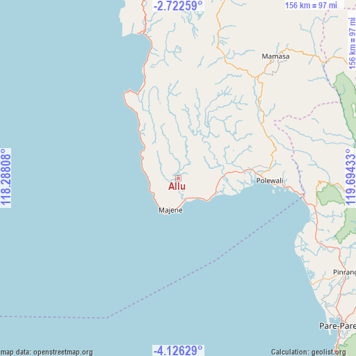
Allu GPS coordinates[2]
3° 25' 28.92" South, 118° 59' 28.32" East
| Map corner | latitude | longitude |
|---|---|---|
| Upper-left | -2.72259°, | 118.28808° |
| Center: | -3.4247°, | 118.9912° |
| Lower-right: | -4.12629°, | 119.69433° |
| Map W x H: | 156.1×156.1 km | = 97×97mi |
| max Lat: | 5.88969° ⇑9.6% North |
| Allu: | -3.4247° |
| min Lat: | ⇓90.4% South -10.934° |
| min Long | Allu | max Long |
| 95.1345° | 118.9912° | 140.9419° |
| W 80.8%⇐ | ⇒19.2% E |
Elevation
Elevation of Allu is 37 m = 121 ft, and this is 192.7 m = 632 ft below average elevation for this country.
| Max E: |
3185 m = 10449 ft | 67.4% |
| Avg. | 229.7 m = 754 ft | |
| Allu | 37 m = 121 ft | |
Min E: |
-1 m = -3 ft | 32.6% |
See also: Indonesia elevation on elevation.city.
Geographical zone
Allu is located in South Torrid zone (between Equator and Tropic of Capricorn). Distance of Equator is 380.8 km =236.6 mi to North.| Distance of | km | miles | from Allu |
|---|---|---|---|
| Equator | 380.8 | 236.6 | to North |
| Tropic Capricorn | 2225.1 | 1382.6 | to South |
| Antarctic Circle | 7020.4 | 4362.3 | to South |
| South Pole | 9626.3 | 5981.5 | to South |


Nearby cities:
15 places around Allu: (largest is in red/bold)
• Cempa Pasar
75 km =46.6 mi,  118°
118°
• Galunggalung
12.8 km =8 mi,  235°
235°
• Lampa
65.8 km =40.9 mi,  113°
113°
• Langnga
75.3 km =46.8 mi,  128°
128°
• Majene
13.1 km =8.1 mi,  190°
190°
• Malunda
48.2 km =30 mi,  341°
341°
• Mamasa
68.7 km =42.7 mi,  38°
38°
• Mambi
56.5 km =35.1 mi,  21°
21°
• Mamuju
83.6 km =51.9 mi,  351°
351°
• Petoosang
0.3 km =0.2 mi, 191°
• Pinrang
83.6 km =51.9 mi, 118°
• Polewali
39.1 km =24.3 mi,  91°
91°
• Somba
16.8 km =10.4 mi,  288°
288°
• Tapalang
63.9 km =39.7 mi, 347°
• Teppo
81.6 km =50.7 mi, 112°
Sources, notices
• [Note1] Compared only with cities in Indonesia existing in our database
• [Src1] Map data: © OpenStreetMap contributors (CC-BY-SA)
• [Src2] Other city data from geonames.org with taken over terms of usage.
• [Src3] Geographical zone / Annual Mean Temperature by Robert A. Rohde @ Wikipedia
