Lela geodata
Lela (West Nusa Tenggara) is a seat of a fourth-order administrative division; located in Indonesia in Asia/Makassar (GMT+8) time zone. In our database, there are 407 cities with bigger population. Compared to other cities in Indonesia, 81.5% of cities are located further ↑North; 80.1% of cities are located further ←West and 73.4% of cities have higher elevation than Lela. Note1


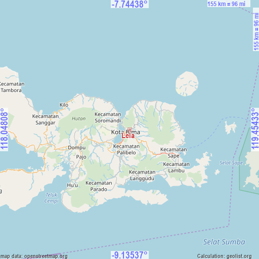
Lela GPS coordinates[2]
8° 26' 25.8" South, 118° 45' 4.32" East
| Map corner | latitude | longitude |
|---|---|---|
| Upper-left | -7.74438°, | 118.04808° |
| Center: | -8.4405°, | 118.7512° |
| Lower-right: | -9.13537°, | 119.45433° |
| Map W x H: | 154.7×154.7 km | = 96.1×96.1mi |
| max Lat: | 5.88969° ⇑81.5% North |
| Lela: | -8.4405° |
| min Lat: | ⇓18.5% South -10.934° |
| min Long | Lela | max Long |
| 95.1345° | 118.7512° | 140.9419° |
| W 80.1%⇐ | ⇒19.9% E |
Elevation
Elevation of Lela is 27 m = 89 ft, and this is 202.7 m = 665 ft below average elevation for this country.
| Max E: |
3185 m = 10449 ft | 73.4% |
| Avg. | 229.7 m = 754 ft | |
| Lela | 27 m = 89 ft | |
Min E: |
-1 m = -3 ft | 26.6% |
See also: Indonesia elevation on elevation.city.
Geographical zone
Lela is located in South Torrid zone (between Equator and Tropic of Capricorn). Distance of Equator is 938.5 km =583.2 mi to North.| Distance of | km | miles | from Lela |
|---|---|---|---|
| Equator | 938.5 | 583.2 | to North |
| Tropic Capricorn | 1667.4 | 1036.1 | to South |
| Antarctic Circle | 6462.7 | 4015.7 | to South |
| South Pole | 9068.6 | 5635 | to South |


Nearby cities:
15 places around Lela: (largest is in red/bold)
• Bima
3.5 km =2.2 mi,  231°
231°
• Dodu Dua
7.3 km =4.5 mi,  137°
137°
• Keli
7.7 km =4.8 mi,  43°
43°
• Kendo Satu
4.4 km =2.7 mi,  134°
134°
• Kolo
8.4 km =5.2 mi,  335°
335°
• Kumbe
5.3 km =3.3 mi,  157°
157°
• Lampe Satu
9.6 km =6 mi,  145°
145°
• Ntobo
3.3 km =2.1 mi,  108°
108°
• Nungga
6.6 km =4.1 mi, 135°
• Penanae
2.6 km =1.6 mi, 147°
• Penaraga
2.9 km =1.8 mi,  166°
166°
• Pisang
3.4 km =2.1 mi, 168°
• Raba
2.4 km =1.5 mi,  191°
191°
• Rato
4.1 km =2.5 mi, 158°
• Rontu
4.4 km =2.7 mi,  176°
176°
Sources, notices
• [Note1] Compared only with cities in Indonesia existing in our database
• [Src1] Map data: © OpenStreetMap contributors (CC-BY-SA)
• [Src2] Other city data from geonames.org with taken over terms of usage.
• [Src3] Geographical zone / Annual Mean Temperature by Robert A. Rohde @ Wikipedia
