Kendo Satu geodata
Kendo Satu (West Nusa Tenggara) is a seat of a fourth-order administrative division; located in Indonesia in Asia/Makassar (GMT+8) time zone. In our database, there are 407 cities with bigger population. Compared to other cities in Indonesia, 82.2% of cities are located further ↑North; 80.3% of cities are located further ←West and 63.2% of cities have higher elevation than Kendo Satu. Note1


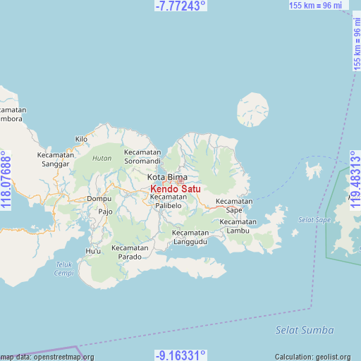
Kendo Satu GPS coordinates[2]
8° 28' 6.6" South, 118° 46' 48" East
| Map corner | latitude | longitude |
|---|---|---|
| Upper-left | -7.77243°, | 118.07688° |
| Center: | -8.4685°, | 118.78° |
| Lower-right: | -9.16331°, | 119.48313° |
| Map W x H: | 154.7×154.7 km | = 96.1×96.1mi |
| max Lat: | 5.88969° ⇑82.2% North |
| Kendo Satu: | -8.4685° |
| min Lat: | ⇓17.8% South -10.934° |
| min Long | Kendo Satu | max Long |
| 95.1345° | 118.78° | 140.9419° |
| W 80.3%⇐ | ⇒19.7% E |
Elevation
Elevation of Kendo Satu is 48 m = 157 ft, and this is 181.7 m = 596 ft below average elevation for this country.
| Max E: |
3185 m = 10449 ft | 63.2% |
| Avg. | 229.7 m = 754 ft | |
| Kendo Satu | 48 m = 157 ft | |
Min E: |
-1 m = -3 ft | 36.8% |
See also: Indonesia elevation on elevation.city.
Geographical zone
Kendo Satu is located in South Torrid zone (between Equator and Tropic of Capricorn). Distance of Equator is 941.6 km =585.1 mi to North.| Distance of | km | miles | from Kendo Satu |
|---|---|---|---|
| Equator | 941.6 | 585.1 | to North |
| Tropic Capricorn | 1664.3 | 1034.1 | to South |
| Antarctic Circle | 6459.6 | 4013.8 | to South |
| South Pole | 9065.5 | 5633 | to South |


Nearby cities:
15 places around Kendo Satu: (largest is in red/bold)
• Bima
5.9 km =3.7 mi,  279°
279°
• Dodu Dua
2.9 km =1.8 mi,  142°
142°
• Kumbe
2.1 km =1.3 mi,  211°
211°
• Lampe Satu
5.3 km =3.3 mi,  154°
154°
• Lela
4.4 km =2.7 mi,  314°
314°
• Ntobo
2.1 km =1.3 mi,  358°
358°
• Ntonggu
7.2 km =4.5 mi,  196°
196°
• Nungga
2.1 km =1.3 mi, 138°
• Penanae
2 km =1.2 mi,  296°
296°
• Penaraga
2.5 km =1.6 mi, 277°
• Pisang
2.5 km =1.6 mi,  266°
266°
• Raba
3.7 km =2.3 mi, 282°
• Rato
1.8 km =1.1 mi,  248°
248°
• Rontu
3.1 km =1.9 mi, 246°
• Ta’a
8.7 km =5.4 mi,  129°
129°
Sources, notices
• [Note1] Compared only with cities in Indonesia existing in our database
• [Src1] Map data: © OpenStreetMap contributors (CC-BY-SA)
• [Src2] Other city data from geonames.org with taken over terms of usage.
• [Src3] Geographical zone / Annual Mean Temperature by Robert A. Rohde @ Wikipedia
