Ntobo geodata
Ntobo (West Nusa Tenggara) is a seat of a fourth-order administrative division; located in Indonesia in Asia/Makassar (GMT+8) time zone. In our database, there are 407 cities with bigger population. Compared to other cities in Indonesia, 81.7% of cities are located further ↑North; 80.2% of cities are located further ←West and 61.8% of cities have higher elevation than Ntobo. Note1


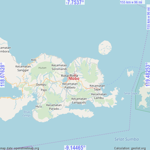
Ntobo GPS coordinates[2]
8° 26' 59.28" South, 118° 46' 45.84" East
| Map corner | latitude | longitude |
|---|---|---|
| Upper-left | -7.7537°, | 118.07628° |
| Center: | -8.4498°, | 118.7794° |
| Lower-right: | -9.14465°, | 119.48253° |
| Map W x H: | 154.7×154.7 km | = 96.1×96.1mi |
| max Lat: | 5.88969° ⇑81.7% North |
| Ntobo: | -8.4498° |
| min Lat: | ⇓18.3% South -10.934° |
| min Long | Ntobo | max Long |
| 95.1345° | 118.7794° | 140.9419° |
| W 80.2%⇐ | ⇒19.8% E |
Elevation
Elevation of Ntobo is 52 m = 171 ft, and this is 177.7 m = 583 ft below average elevation for this country.
| Max E: |
3185 m = 10449 ft | 61.8% |
| Avg. | 229.7 m = 754 ft | |
| Ntobo | 52 m = 171 ft | |
Min E: |
-1 m = -3 ft | 38.2% |
See also: Indonesia elevation on elevation.city.
Geographical zone
Ntobo is located in South Torrid zone (between Equator and Tropic of Capricorn). Distance of Equator is 939.5 km =583.8 mi to North.| Distance of | km | miles | from Ntobo |
|---|---|---|---|
| Equator | 939.5 | 583.8 | to North |
| Tropic Capricorn | 1666.4 | 1035.5 | to South |
| Antarctic Circle | 6461.6 | 4015.1 | to South |
| South Pole | 9067.5 | 5634.3 | to South |


Nearby cities:
15 places around Ntobo: (largest is in red/bold)
• Bima
5.9 km =3.7 mi,  258°
258°
• Dodu Dua
4.8 km =3 mi,  157°
157°
• Keli
7 km =4.3 mi,  18°
18°
• Kendo Satu
2.1 km =1.3 mi,  178°
178°
• Kumbe
4 km =2.5 mi,  194°
194°
• Lampe Satu
7.3 km =4.5 mi, 160°
• Lela
3.3 km =2.1 mi,  288°
288°
• Ntonggu
9.2 km =5.7 mi, 192°
• Nungga
4 km =2.5 mi, 157°
• Penanae
2.1 km =1.3 mi,  235°
235°
• Penaraga
3 km =1.9 mi,  233°
233°
• Pisang
3.3 km =2.1 mi, 227°
• Raba
3.8 km =2.4 mi,  250°
250°
• Rato
3.2 km =2 mi,  210°
210°
• Rontu
4.3 km =2.7 mi,  220°
220°
Sources, notices
• [Note1] Compared only with cities in Indonesia existing in our database
• [Src1] Map data: © OpenStreetMap contributors (CC-BY-SA)
• [Src2] Other city data from geonames.org with taken over terms of usage.
• [Src3] Geographical zone / Annual Mean Temperature by Robert A. Rohde @ Wikipedia
