Barejulat geodata
Barejulat (West Nusa Tenggara) is a seat of a fourth-order administrative division; located in Indonesia in Asia/Makassar (GMT+8) time zone. In our database, there are 407 cities with bigger population. Compared to other cities in Indonesia, 88.4% of cities are located further ↑North; 76.5% of cities are located further ←West and 60.6% of cities have lower elevation than Barejulat. Note1


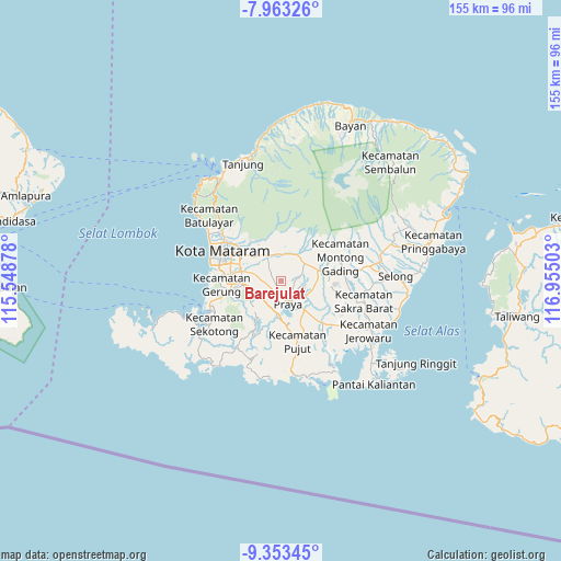
Barejulat GPS coordinates[2]
8° 39' 32.4" South, 116° 15' 6.84" East
| Map corner | latitude | longitude |
|---|---|---|
| Upper-left | -7.96326°, | 115.54878° |
| Center: | -8.659°, | 116.2519° |
| Lower-right: | -9.35345°, | 116.95503° |
| Map W x H: | 154.6×154.6 km | = 96.1×96.1mi |
| max Lat: | 5.88969° ⇑88.4% North |
| Barejulat: | -8.659° |
| min Lat: | ⇓11.6% South -10.934° |
| min Long | Barejulat | max Long |
| 95.1345° | 116.2519° | 140.9419° |
| W 76.5%⇐ | ⇒23.5% E |
Elevation
Elevation of Barejulat is 171 m = 561 ft, and this is 58.7 m = 193 ft below average elevation for this country.
| Max E: |
3185 m = 10449 ft | 39.4% |
| Avg. | 229.7 m = 754 ft | |
| Barejulat | 171 m = 561 ft | |
Min E: |
-1 m = -3 ft | 60.6% |
See also: Indonesia elevation on elevation.city.
Geographical zone
Barejulat is located in South Torrid zone (between Equator and Tropic of Capricorn). Distance of Equator is 962.8 km =598.3 mi to North.| Distance of | km | miles | from Barejulat |
|---|---|---|---|
| Equator | 962.8 | 598.3 | to North |
| Tropic Capricorn | 1643.1 | 1021 | to South |
| Antarctic Circle | 6438.4 | 4000.6 | to South |
| South Pole | 9044.3 | 5619.9 | to South |


Nearby cities:
15 places around Barejulat: (largest is in red/bold)
• Barabali
7.3 km =4.5 mi,  59°
59°
• Batukuta
8.5 km =5.3 mi,  317°
317°
• Batutulis
5.5 km =3.4 mi,  229°
229°
• Blong Daye
4.8 km =3 mi,  217°
217°
• Bodak
6.4 km =4 mi,  84°
84°
• Kembangkerang Satu
8.5 km =5.3 mi,  36°
36°
• Lendangtampel Daya
6.5 km =4 mi, 37°
• Mantang
8.3 km =5.2 mi,  54°
54°
• Pagutan
5 km =3.1 mi, 45°
• Pendaleman
3.1 km =1.9 mi,  204°
204°
• Praya
5.5 km =3.4 mi,  158°
158°
• Semayan
7.6 km =4.7 mi,  152°
152°
• Sintung Timur
6.4 km =4 mi,  329°
329°
• Tanakbeak Daye
7.9 km =4.9 mi, 317°
• Tanaktepong
8.3 km =5.2 mi, 327°
Sources, notices
• [Note1] Compared only with cities in Indonesia existing in our database
• [Src1] Map data: © OpenStreetMap contributors (CC-BY-SA)
• [Src2] Other city data from geonames.org with taken over terms of usage.
• [Src3] Geographical zone / Annual Mean Temperature by Robert A. Rohde @ Wikipedia
