Kedungrejo geodata
Kedungrejo (East Java) is a seat of a fourth-order administrative division; located in Indonesia in Asia/Jakarta (GMT+7) time zone. In our database, there are 407 cities with bigger population. Compared to other cities in Indonesia, 81.5% of cities are located further ↑North; 69.1% of cities are located further ←West and 85.2% of cities have higher elevation than Kedungrejo. Note1


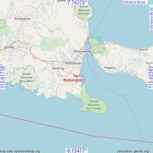
Kedungrejo GPS coordinates[2]
8° 26' 23.64" South, 114° 19' 13.8" East
| Map corner | latitude | longitude |
|---|---|---|
| Upper-left | -7.74378°, | 113.61738° |
| Center: | -8.4399°, | 114.3205° |
| Lower-right: | -9.13477°, | 115.02363° |
| Map W x H: | 154.7×154.7 km | = 96.1×96.1mi |
| max Lat: | 5.88969° ⇑81.5% North |
| Kedungrejo: | -8.4399° |
| min Lat: | ⇓18.5% South -10.934° |
| min Long | Kedungrejo | max Long |
| 95.1345° | 114.3205° | 140.9419° |
| W 69.1%⇐ | ⇒30.9% E |
Elevation
Elevation of Kedungrejo is 14 m = 46 ft, and this is 215.7 m = 708 ft below average elevation for this country.
| Max E: |
3185 m = 10449 ft | 85.2% |
| Avg. | 229.7 m = 754 ft | |
| Kedungrejo | 14 m = 46 ft | |
Min E: |
-1 m = -3 ft | 14.8% |
See also: Indonesia elevation on elevation.city.
Geographical zone
Kedungrejo is located in South Torrid zone (between Equator and Tropic of Capricorn). Distance of Equator is 938.4 km =583.1 mi to North.| Distance of | km | miles | from Kedungrejo |
|---|---|---|---|
| Equator | 938.4 | 583.1 | to North |
| Tropic Capricorn | 1667.5 | 1036.1 | to South |
| Antarctic Circle | 6462.7 | 4015.7 | to South |
| South Pole | 9068.6 | 5635 | to South |


Nearby cities:
15 places around Kedungrejo: (largest is in red/bold)
• Bagorejo
5.2 km =3.2 mi,  340°
340°
• Curahpacul Satu
3.9 km =2.4 mi,  240°
240°
• Karanglo
7.7 km =4.8 mi,  322°
322°
• Kedungsumur
6.5 km =4 mi,  180°
180°
• Kedungwringin Satu
2.2 km =1.4 mi,  134°
134°
• Kumendung Satu
6.4 km =4 mi,  12°
12°
• Muncar
1.6 km =1 mi,  62°
62°
• Rejoagung Satu
7 km =4.3 mi,  350°
350°
• Rumping
6.1 km =3.8 mi,  234°
234°
• Srono
7.4 km =4.6 mi,  306°
306°
• Sumberan
7.3 km =4.5 mi, 307°
• Sumberberas
4 km =2.5 mi, 182°
• Sumbersewu
4.3 km =2.7 mi, 9°
• Wringinanom Satu
6.5 km =4 mi,  213°
213°
• Wringinputih
4.3 km =2.7 mi,  159°
159°
Sources, notices
• [Note1] Compared only with cities in Indonesia existing in our database
• [Src1] Map data: © OpenStreetMap contributors (CC-BY-SA)
• [Src2] Other city data from geonames.org with taken over terms of usage.
• [Src3] Geographical zone / Annual Mean Temperature by Robert A. Rohde @ Wikipedia
