Narmada geodata
Narmada (West Nusa Tenggara) is a seat of a third-order administrative division; located in Indonesia in Asia/Makassar (GMT+8) time zone. In our database, there are 407 cities with bigger population. Compared to other cities in Indonesia, 86.6% of cities are located further ↑North; 76.3% of cities are located further ←West and 57% of cities have lower elevation than Narmada. Note1


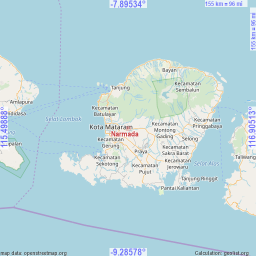
Narmada GPS coordinates[2]
8° 35' 28.32" South, 116° 12' 7.2" East
| Map corner | latitude | longitude |
|---|---|---|
| Upper-left | -7.89534°, | 115.49888° |
| Center: | -8.5912°, | 116.202° |
| Lower-right: | -9.28578°, | 116.90513° |
| Map W x H: | 154.6×154.6 km | = 96.1×96.1mi |
| max Lat: | 5.88969° ⇑86.6% North |
| Narmada: | -8.5912° |
| min Lat: | ⇓13.4% South -10.934° |
| min Long | Narmada | max Long |
| 95.1345° | 116.202° | 140.9419° |
| W 76.3%⇐ | ⇒23.7% E |
Elevation
Elevation of Narmada is 137 m = 449 ft, and this is 92.7 m = 304 ft below average elevation for this country.
| Max E: |
3185 m = 10449 ft | 43% |
| Avg. | 229.7 m = 754 ft | |
| Narmada | 137 m = 449 ft | |
Min E: |
-1 m = -3 ft | 57% |
See also: Indonesia elevation on elevation.city.
Geographical zone
Narmada is located in South Torrid zone (between Equator and Tropic of Capricorn). Distance of Equator is 955.3 km =593.6 mi to North.| Distance of | km | miles | from Narmada |
|---|---|---|---|
| Equator | 955.3 | 593.6 | to North |
| Tropic Capricorn | 1650.7 | 1025.7 | to South |
| Antarctic Circle | 6445.9 | 4005.3 | to South |
| South Pole | 9051.8 | 5624.5 | to South |


Nearby cities:
15 places around Narmada: (largest is in red/bold)
• Babakan Barat
7.2 km =4.5 mi,  260°
260°
• Batukuta
1.3 km =0.8 mi,  191°
191°
• Bengkel Utara
6.5 km =4 mi,  245°
245°
• Dasangeria Selatan
7.1 km =4.4 mi,  303°
303°
• Dumandesa
6.5 km =4 mi, 297°
• Jejelok
4.6 km =2.9 mi,  239°
239°
• Karang Kuripan
7.2 km =4.5 mi,  227°
227°
• Kediri
7.3 km =4.5 mi, 229°
• Lingsar
3 km =1.9 mi,  313°
313°
• Selagalas
6.5 km =4 mi,  279°
279°
• Selat
1.4 km =0.9 mi,  39°
39°
• Sesaot Lauq
7.3 km =4.5 mi, 40°
• Sintung Timur
3 km =1.9 mi,  133°
133°
• Tanakbeak Daye
1.7 km =1.1 mi,  177°
177°
• Tanaktepong
1.1 km =0.7 mi,  116°
116°
Sources, notices
• [Note1] Compared only with cities in Indonesia existing in our database
• [Src1] Map data: © OpenStreetMap contributors (CC-BY-SA)
• [Src2] Other city data from geonames.org with taken over terms of usage.
• [Src3] Geographical zone / Annual Mean Temperature by Robert A. Rohde @ Wikipedia
