Talok geodata
Talok (Central Java) is a seat of a fourth-order administrative division; located in Indonesia in Asia/Jakarta (GMT+7) time zone. In our database, there are 407 cities with bigger population. Compared to other cities in Indonesia, 64.1% of cities are located further ↓South; 61.7% of cities are located further →East and 56.1% of cities have higher elevation than Talok. Note1


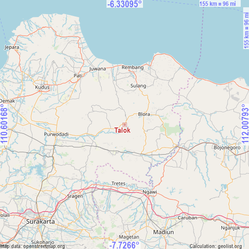
Talok GPS coordinates[2]
7° 1' 45.48" South, 111° 18' 17.28" East
| Map corner | latitude | longitude |
|---|---|---|
| Upper-left | -6.33095°, | 110.60168° |
| Center: | -7.0293°, | 111.3048° |
| Lower-right: | -7.7266°, | 112.00793° |
| Map W x H: | 155.2×155.2 km | = 96.4×96.4mi |
| max Lat: | 5.88969° ⇑35.9% North |
| Talok: | -7.0293° |
| min Lat: | ⇓64.1% South -10.934° |
| min Long | Talok | max Long |
| 95.1345° | 111.3048° | 140.9419° |
| W 38.3%⇐ | ⇒61.7% E |
Elevation
Elevation of Talok is 78 m = 256 ft, and this is 151.7 m = 498 ft below average elevation for this country.
| Max E: |
3185 m = 10449 ft | 56.1% |
| Avg. | 229.7 m = 754 ft | |
| Talok | 78 m = 256 ft | |
Min E: |
-1 m = -3 ft | 43.9% |
See also: Indonesia elevation on elevation.city.
Geographical zone
Talok is located in South Torrid zone (between Equator and Tropic of Capricorn). Distance of Equator is 781.6 km =485.7 mi to North.| Distance of | km | miles | from Talok |
|---|---|---|---|
| Equator | 781.6 | 485.7 | to North |
| Tropic Capricorn | 1824.3 | 1133.6 | to South |
| Antarctic Circle | 6619.6 | 4113.2 | to South |
| South Pole | 9225.5 | 5732.5 | to South |


Nearby cities:
15 places around Talok: (largest is in red/bold)
• Banjarejo
4.4 km =2.7 mi,  97°
97°
• Berbak
3.6 km =2.2 mi,  15°
15°
• Bradag
4.1 km =2.5 mi,  345°
345°
• Gapuk
3.2 km =2 mi, 97°
• Gesik
3.7 km =2.3 mi,  120°
120°
• Gondang
2.6 km =1.6 mi,  37°
37°
• Karangtengah
1.8 km =1.1 mi,  130°
130°
• Kendayakan
2.7 km =1.7 mi,  168°
168°
• Ketanggi
2 km =1.2 mi, 39°
• Ngawen
3 km =1.9 mi, 17°
• Pecaren
2.5 km =1.6 mi, 348°
• Plumbon
3 km =1.9 mi,  207°
207°
• Punggursugih
1.9 km =1.2 mi, 20°
• Sambirejo
4.2 km =2.6 mi, 115°
• Trembulrejo
1.1 km =0.7 mi,  13°
13°
Sources, notices
• [Note1] Compared only with cities in Indonesia existing in our database
• [Src1] Map data: © OpenStreetMap contributors (CC-BY-SA)
• [Src2] Other city data from geonames.org with taken over terms of usage.
• [Src3] Geographical zone / Annual Mean Temperature by Robert A. Rohde @ Wikipedia
