Maukaro geodata
Maukaro (East Nusa Tenggara) is a seat of a fourth-order administrative division; located in Indonesia in Asia/Makassar (GMT+8) time zone. In our database, there are 407 cities with bigger population. Compared to other cities in Indonesia, 87.3% of cities are located further ↑North; 86.7% of cities are located further ←West and 89% of cities have higher elevation than Maukaro. Note1


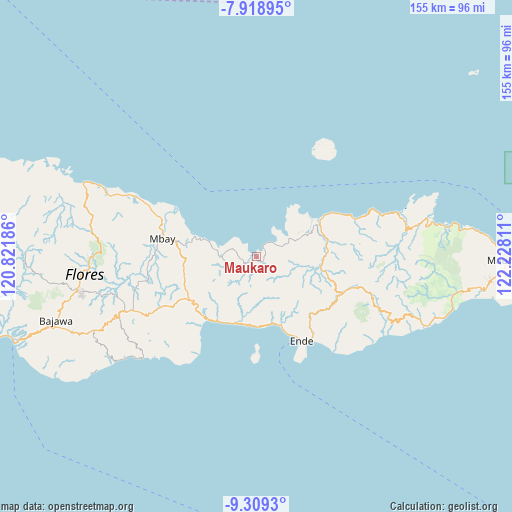
Maukaro GPS coordinates[2]
8° 36' 53.136" South, 121° 31' 29.928" East
| Map corner | latitude | longitude |
|---|---|---|
| Upper-left | -7.91895°, | 120.82186° |
| Center: | -8.61476°, | 121.52498° |
| Lower-right: | -9.3093°, | 122.22811° |
| Map W x H: | 154.6×154.6 km | = 96.1×96.1mi |
| max Lat: | 5.88969° ⇑87.3% North |
| Maukaro: | -8.61476° |
| min Lat: | ⇓12.7% South -10.934° |
| min Long | Maukaro | max Long |
| 95.1345° | 121.52498° | 140.9419° |
| W 86.7%⇐ | ⇒13.3% E |
Elevation
Elevation of Maukaro is 11 m = 36 ft, and this is 218.7 m = 718 ft below average elevation for this country.
| Max E: |
3185 m = 10449 ft | 89% |
| Avg. | 229.7 m = 754 ft | |
| Maukaro | 11 m = 36 ft | |
Min E: |
-1 m = -3 ft | 11% |
See also: Indonesia elevation on elevation.city.
Geographical zone
Maukaro is located in South Torrid zone (between Equator and Tropic of Capricorn). Distance of Equator is 957.9 km =595.2 mi to North.| Distance of | km | miles | from Maukaro |
|---|---|---|---|
| Equator | 957.9 | 595.2 | to North |
| Tropic Capricorn | 1648 | 1024 | to South |
| Antarctic Circle | 6443.3 | 4003.7 | to South |
| South Pole | 9049.2 | 5622.9 | to South |


Nearby cities:
15 places around Maukaro: (largest is in red/bold)
• Arwea
14.3 km =8.9 mi,  197°
197°
• Boafeo
13.9 km =8.6 mi,  127°
127°
• Boujawa
17.8 km =11.1 mi,  138°
138°
• Kamubheka
6.7 km =4.2 mi,  216°
216°
• Kuekobo
18.4 km =11.4 mi,  232°
232°
• Mbani
16.3 km =10.1 mi,  118°
118°
• Mukusaki
11.5 km =7.1 mi,  61°
61°
• Nangakeo
20.5 km =12.7 mi,  166°
166°
• Nangapanda
20.7 km =12.9 mi, 197°
• Oja
13.3 km =8.3 mi, 229°
• Puukau
16.1 km =10 mi, 220°
• Rerawere
6.5 km =4 mi,  52°
52°
• Tendaleo
19.6 km =12.2 mi,  100°
100°
• Wakaseko
6.5 km =4 mi,  247°
247°
• Watuapi
11.5 km =7.1 mi,  271°
271°
Sources, notices
• [Note1] Compared only with cities in Indonesia existing in our database
• [Src1] Map data: © OpenStreetMap contributors (CC-BY-SA)
• [Src2] Other city data from geonames.org with taken over terms of usage.
• [Src3] Geographical zone / Annual Mean Temperature by Robert A. Rohde @ Wikipedia
