Boafeo geodata
Boafeo (East Nusa Tenggara) is a seat of a fourth-order administrative division; located in Indonesia in Asia/Makassar (GMT+8) time zone. In our database, there are 407 cities with bigger population. Compared to other cities in Indonesia, 89% of cities are located further ↑North; 86.9% of cities are located further ←West and 92.4% of cities have lower elevation than Boafeo. Note1


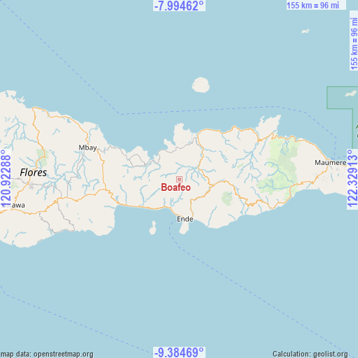
Boafeo GPS coordinates[2]
8° 41' 25.08" South, 121° 37' 33.6" East
| Map corner | latitude | longitude |
|---|---|---|
| Upper-left | -7.99462°, | 120.92288° |
| Center: | -8.6903°, | 121.626° |
| Lower-right: | -9.38469°, | 122.32913° |
| Map W x H: | 154.6×154.6 km | = 96.1×96.1mi |
| max Lat: | 5.88969° ⇑89% North |
| Boafeo: | -8.6903° |
| min Lat: | ⇓11% South -10.934° |
| min Long | Boafeo | max Long |
| 95.1345° | 121.626° | 140.9419° |
| W 86.9%⇐ | ⇒13.1% E |
Elevation
Elevation of Boafeo is 720 m = 2362 ft, and this is 490.3 m = 1609 ft above average elevation for this country.
| Max E: |
3185 m = 10449 ft | 7.6% |
| Boafeo | 720 m 2362 ft | |
| Avg. | 229.7 m = 754 ft | |
Min E: |
-1 m = -3 ft | 92.4% |
See also: Indonesia elevation on elevation.city.
Geographical zone
Boafeo is located in South Torrid zone (between Equator and Tropic of Capricorn). Distance of Equator is 966.3 km =600.4 mi to North.| Distance of | km | miles | from Boafeo |
|---|---|---|---|
| Equator | 966.3 | 600.4 | to North |
| Tropic Capricorn | 1639.6 | 1018.8 | to South |
| Antarctic Circle | 6434.9 | 3998.5 | to South |
| South Pole | 9040.8 | 5617.7 | to South |


Nearby cities:
15 places around Boafeo: (largest is in red/bold)
• Aefeo
9.7 km =6 mi,  147°
147°
• Boujawa
4.9 km =3 mi,  171°
171°
• Detumbawa
11.8 km =7.3 mi, 154°
• Kengga
12.3 km =7.6 mi,  128°
128°
• Kombandaru
11 km =6.8 mi,  193°
193°
• Mbani
3.2 km =2 mi,  79°
79°
• Nangakeo
13.3 km =8.3 mi,  208°
208°
• Nuasepu
11.7 km =7.3 mi,  175°
175°
• Puubheto
11.9 km =7.4 mi,  199°
199°
• Puuperi
11.8 km =7.3 mi, 168°
• Rerawere
13.7 km =8.5 mi,  334°
334°
• Roa
12.6 km =7.8 mi, 126°
• Tendaleo
9.5 km =5.9 mi,  59°
59°
• Wolofeo
7.2 km =4.5 mi,  122°
122°
• Wolomage
12.2 km =7.6 mi,  96°
96°
Sources, notices
• [Note1] Compared only with cities in Indonesia existing in our database
• [Src1] Map data: © OpenStreetMap contributors (CC-BY-SA)
• [Src2] Other city data from geonames.org with taken over terms of usage.
• [Src3] Geographical zone / Annual Mean Temperature by Robert A. Rohde @ Wikipedia
