Natarmage geodata
Natarmage (East Nusa Tenggara) is a seat of a fourth-order administrative division; located in Indonesia in Asia/Makassar (GMT+8) time zone. In our database, there are 407 cities with bigger population. Compared to other cities in Indonesia, 87% of cities are located further ↑North; 89.1% of cities are located further ←West and 71.9% of cities have lower elevation than Natarmage. Note1


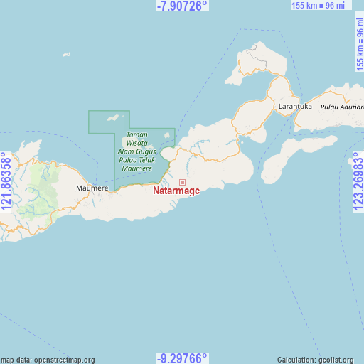
Natarmage GPS coordinates[2]
8° 36' 11.16" South, 122° 34' 0.12" East
| Map corner | latitude | longitude |
|---|---|---|
| Upper-left | -7.90726°, | 121.86358° |
| Center: | -8.6031°, | 122.5667° |
| Lower-right: | -9.29766°, | 123.26983° |
| Map W x H: | 154.6×154.6 km | = 96.1×96.1mi |
| max Lat: | 5.88969° ⇑87% North |
| Natarmage: | -8.6031° |
| min Lat: | ⇓13% South -10.934° |
| min Long | Natarmage | max Long |
| 95.1345° | 122.5667° | 140.9419° |
| W 89.1%⇐ | ⇒10.9% E |
Elevation
Elevation of Natarmage is 320 m = 1050 ft, and this is 90.3 m = 296 ft above average elevation for this country.
| Max E: |
3185 m = 10449 ft | 28.1% |
| Natarmage | 320 m 1050 ft | |
| Avg. | 229.7 m = 754 ft | |
Min E: |
-1 m = -3 ft | 71.9% |
See also: Indonesia elevation on elevation.city.
Geographical zone
Natarmage is located in South Torrid zone (between Equator and Tropic of Capricorn). Distance of Equator is 956.6 km =594.4 mi to North.| Distance of | km | miles | from Natarmage |
|---|---|---|---|
| Equator | 956.6 | 594.4 | to North |
| Tropic Capricorn | 1649.3 | 1024.8 | to South |
| Antarctic Circle | 6444.6 | 4004.5 | to South |
| South Pole | 9050.5 | 5623.7 | to South |


Nearby cities:
15 places around Natarmage: (largest is in red/bold)
• Boganatar
13.7 km =8.5 mi,  36°
36°
• Boru
18.1 km =11.2 mi,  61°
61°
• Duang
18.4 km =11.4 mi,  74°
74°
• Ewa
6.9 km =4.3 mi,  250°
250°
• Hewa
15.3 km =9.5 mi,  86°
86°
• Hila
6.8 km =4.2 mi,  48°
48°
• Kokang
13 km =8.1 mi,  96°
96°
• Nangahale
8.2 km =5.1 mi,  306°
306°
• Natargran
16.2 km =10.1 mi,  265°
265°
• Natarleba
10.3 km =6.4 mi,  344°
344°
• Nebe
14.4 km =8.9 mi,  357°
357°
• Pedat
16.8 km =10.4 mi,  223°
223°
• Talibura
9.8 km =6.1 mi,  332°
332°
• Waigete
16.2 km =10.1 mi, 266°
• Wolometang
3.8 km =2.4 mi, 62°
Sources, notices
• [Note1] Compared only with cities in Indonesia existing in our database
• [Src1] Map data: © OpenStreetMap contributors (CC-BY-SA)
• [Src2] Other city data from geonames.org with taken over terms of usage.
• [Src3] Geographical zone / Annual Mean Temperature by Robert A. Rohde @ Wikipedia
