Pondokwungu geodata
Pondokwungu (Central Java) is a seat of a fourth-order administrative division; located in Indonesia in Asia/Jakarta (GMT+7) time zone. In our database, there are 407 cities with bigger population. Compared to other cities in Indonesia, 57.2% of cities are located further ↑North; 67.8% of cities are located further →East and 92.1% of cities have higher elevation than Pondokwungu. Note1


Pondokwungu GPS coordinates[2]
7° 33' 20.16" South, 108° 47' 46.716" East
| Map corner | latitude | longitude |
|---|---|---|
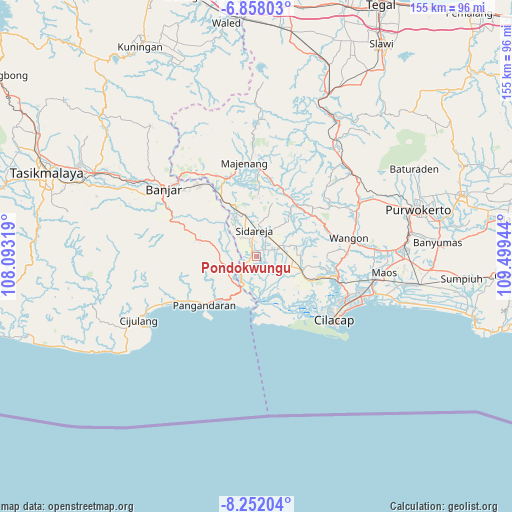
| Upper-left | -6.85803°, | 108.09319° |
| Center: | -7.5556°, | 108.79631° |
| Lower-right: | -8.25204°, | 109.49944° |
| Map W x H: | 155×155 km | = 96.3×96.3mi |
| max Lat: | 5.88969° ⇑57.2% North |
| Pondokwungu: | -7.5556° |
| min Lat: | ⇓42.8% South -10.934° |
| min Long | Pondokwungu | max Long |
| 95.1345° | 108.79631° | 140.9419° |
| W 32.2%⇐ | ⇒67.8% E |
Elevation
Elevation of Pondokwungu is 9 m = 30 ft, and this is 220.7 m = 724 ft below average elevation for this country.
| Max E: |
3185 m = 10449 ft | 92.1% |
| Avg. | 229.7 m = 754 ft | |
| Pondokwungu | 9 m = 30 ft | |
Min E: |
-1 m = -3 ft | 7.9% |
See also: Indonesia elevation on elevation.city.
Geographical zone
Pondokwungu is located in South Torrid zone (between Equator and Tropic of Capricorn). Distance of Equator is 840.1 km =522 mi to North.| Distance of | km | miles | from Pondokwungu |
|---|---|---|---|
| Equator | 840.1 | 522 | to North |
| Tropic Capricorn | 1765.8 | 1097.2 | to South |
| Antarctic Circle | 6561.1 | 4076.9 | to South |
| South Pole | 9167 | 5696.1 | to South |


Nearby cities:
15 places around Pondokwungu: (largest is in red/bold)
• Ciklapa
5.3 km =3.3 mi,  13°
13°
• Cinyawang
3.9 km =2.4 mi,  238°
238°
• Cipari
2.1 km =1.3 mi, 14°
• Dukuhtengah
4.3 km =2.7 mi, 6°
• Kalenaren
3 km =1.9 mi,  204°
204°
• Kalenpring
5.1 km =3.2 mi,  229°
229°
• Kedungbakung
6.1 km =3.8 mi,  335°
335°
• Kedungbulu
2.4 km =1.5 mi,  324°
324°
• Kedungreja
5.9 km =3.7 mi, 342°
• Mulyosari
5.5 km =3.4 mi,  347°
347°
• Purwodadi
6.5 km =4 mi,  217°
217°
• Sentul
6.5 km =4 mi,  266°
266°
• Sidaurip
4.6 km =2.9 mi,  81°
81°
• Sidaurip
5.3 km =3.3 mi,  286°
286°
• Wanadadi
3.8 km =2.4 mi,  48°
48°
Sources, notices
• [Note1] Compared only with cities in Indonesia existing in our database
• [Src1] Map data: © OpenStreetMap contributors (CC-BY-SA)
• [Src2] Other city data from geonames.org with taken over terms of usage.
• [Src3] Geographical zone / Annual Mean Temperature by Robert A. Rohde @ Wikipedia
