Tanagara geodata
Tanagara (Banten) is a seat of a fourth-order administrative division; located in Indonesia in Asia/Jakarta (GMT+7) time zone. In our database, there are 407 cities with bigger population. Compared to other cities in Indonesia, 87% of cities are located further ↓South; 89.6% of cities are located further →East and 83.2% of cities have lower elevation than Tanagara. Note1


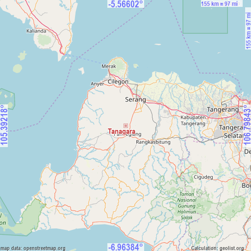
Tanagara GPS coordinates[2]
6° 15' 55.44" South, 106° 5' 43.08" East
| Map corner | latitude | longitude |
|---|---|---|
| Upper-left | -5.56602°, | 105.39218° |
| Center: | -6.2654°, | 106.0953° |
| Lower-right: | -6.96384°, | 106.79843° |
| Map W x H: | 155.4×155.4 km | = 96.6×96.6mi |
| max Lat: | 5.88969° ⇑13% North |
| Tanagara: | -6.2654° |
| min Lat: | ⇓87% South -10.934° |
| min Long | Tanagara | max Long |
| 95.1345° | 106.0953° | 140.9419° |
| W 10.4%⇐ | ⇒89.6% E |
Elevation
Elevation of Tanagara is 483 m = 1585 ft, and this is 253.3 m = 831 ft above average elevation for this country.
| Max E: |
3185 m = 10449 ft | 16.8% |
| Tanagara | 483 m 1585 ft | |
| Avg. | 229.7 m = 754 ft | |
Min E: |
-1 m = -3 ft | 83.2% |
See also: Indonesia elevation on elevation.city.
Geographical zone
Tanagara is located in South Torrid zone (between Equator and Tropic of Capricorn). Distance of Equator is 696.6 km =432.8 mi to North.| Distance of | km | miles | from Tanagara |
|---|---|---|---|
| Equator | 696.6 | 432.8 | to North |
| Tropic Capricorn | 1909.3 | 1186.4 | to South |
| Antarctic Circle | 6704.5 | 4166 | to South |
| South Pole | 9310.4 | 5785.2 | to South |


Nearby cities:
15 places around Tanagara: (largest is in red/bold)
• Campraksanta
4.5 km =2.8 mi,  205°
205°
• Cemplang
4.5 km =2.8 mi,  330°
330°
• Cigudang
2.5 km =1.6 mi,  16°
16°
• Jalanbaru
2.8 km =1.7 mi,  80°
80°
• Juhut
3.6 km =2.2 mi,  159°
159°
• Kaburon
4.3 km =2.7 mi,  125°
125°
• Kaduela
2.7 km =1.7 mi, 325°
• Kaduengang
2.4 km =1.5 mi,  284°
284°
• Kadukaung
2.3 km =1.4 mi,  33°
33°
• Kadumantung
3.7 km =2.3 mi,  136°
136°
• Kalepasan
1.8 km =1.1 mi,  289°
289°
• Karangtanjung
4.5 km =2.8 mi, 125°
• Lengor
4.5 km =2.8 mi, 21°
• Sindanghayu
1.1 km =0.7 mi,  107°
107°
• Sukacai
3.6 km =2.2 mi, 27°
Sources, notices
• [Note1] Compared only with cities in Indonesia existing in our database
• [Src1] Map data: © OpenStreetMap contributors (CC-BY-SA)
• [Src2] Other city data from geonames.org with taken over terms of usage.
• [Src3] Geographical zone / Annual Mean Temperature by Robert A. Rohde @ Wikipedia
