Rokoy geodata
Rokoy (Banten) is a seat of a fourth-order administrative division; located in Indonesia in Asia/Jakarta (GMT+7) time zone. In our database, there are 407 cities with bigger population. Compared to other cities in Indonesia, 86.4% of cities are located further ↓South; 90.1% of cities are located further →East and 68.1% of cities have lower elevation than Rokoy. Note1


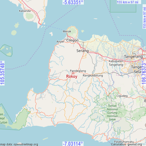
Rokoy GPS coordinates[2]
6° 19' 58.08" South, 106° 3' 38.16" East
| Map corner | latitude | longitude |
|---|---|---|
| Upper-left | -5.63351°, | 105.35748° |
| Center: | -6.3328°, | 106.0606° |
| Lower-right: | -7.03114°, | 106.76373° |
| Map W x H: | 155.4×155.4 km | = 96.6×96.6mi |
| max Lat: | 5.88969° ⇑13.6% North |
| Rokoy: | -6.3328° |
| min Lat: | ⇓86.4% South -10.934° |
| min Long | Rokoy | max Long |
| 95.1345° | 106.0606° | 140.9419° |
| W 9.9%⇐ | ⇒90.1% E |
Elevation
Elevation of Rokoy is 264 m = 866 ft, and this is 34.3 m = 113 ft above average elevation for this country.
| Max E: |
3185 m = 10449 ft | 31.9% |
| Rokoy | 264 m 866 ft | |
| Avg. | 229.7 m = 754 ft | |
Min E: |
-1 m = -3 ft | 68.1% |
See also: Indonesia elevation on elevation.city.
Geographical zone
Rokoy is located in South Torrid zone (between Equator and Tropic of Capricorn). Distance of Equator is 704.1 km =437.5 mi to North.| Distance of | km | miles | from Rokoy |
|---|---|---|---|
| Equator | 704.1 | 437.5 | to North |
| Tropic Capricorn | 1901.8 | 1181.7 | to South |
| Antarctic Circle | 6697 | 4161.3 | to South |
| South Pole | 9302.9 | 5780.6 | to South |


Nearby cities:
15 places around Rokoy: (largest is in red/bold)
• Babakan
2.6 km =1.6 mi,  146°
146°
• Batubantar
2.6 km =1.6 mi,  222°
222°
• Bengkung
2.6 km =1.6 mi,  275°
275°
• Cibebek
2 km =1.2 mi,  118°
118°
• Cidahu
2.4 km =1.5 mi,  350°
350°
• Cilanggar
2.1 km =1.3 mi,  272°
272°
• Cipacung Landeuh
2.5 km =1.6 mi,  80°
80°
• Curuggaru
1.4 km =0.9 mi, 152°
• Girihieum
0.9 km =0.6 mi, 83°
• Kalahang
3.2 km =2 mi,  195°
195°
• Kukulu
1.4 km =0.9 mi, 273°
• Panday
2.5 km =1.6 mi, 221°
• Pasarnangka
2.9 km =1.8 mi, 275°
• Penikebon
3.1 km =1.9 mi,  108°
108°
• Rocek
3.1 km =1.9 mi,  207°
207°
Sources, notices
• [Note1] Compared only with cities in Indonesia existing in our database
• [Src1] Map data: © OpenStreetMap contributors (CC-BY-SA)
• [Src2] Other city data from geonames.org with taken over terms of usage.
• [Src3] Geographical zone / Annual Mean Temperature by Robert A. Rohde @ Wikipedia
