Karangpawitan geodata
Karangpawitan (West Java) is a seat of a fourth-order administrative division; located in Indonesia in Asia/Jakarta (GMT+7) time zone. In our database, there are 407 cities with bigger population. Compared to other cities in Indonesia, 54.1% of cities are located further ↑North; 84.3% of cities are located further →East and 68.4% of cities have lower elevation than Karangpawitan. Note1


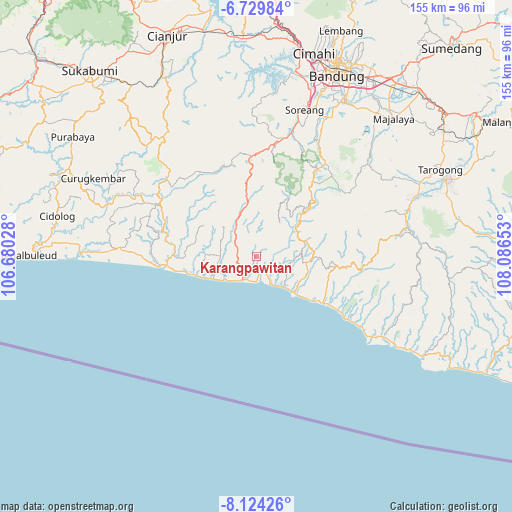
Karangpawitan GPS coordinates[2]
7° 25' 39.36" South, 107° 23' 0.24" East
| Map corner | latitude | longitude |
|---|---|---|
| Upper-left | -6.72984°, | 106.68028° |
| Center: | -7.4276°, | 107.3834° |
| Lower-right: | -8.12426°, | 108.08653° |
| Map W x H: | 155×155 km | = 96.3×96.3mi |
| max Lat: | 5.88969° ⇑54.1% North |
| Karangpawitan: | -7.4276° |
| min Lat: | ⇓45.9% South -10.934° |
| min Long | Karangpawitan | max Long |
| 95.1345° | 107.3834° | 140.9419° |
| W 15.7%⇐ | ⇒84.3% E |
Elevation
Elevation of Karangpawitan is 270 m = 886 ft, and this is 40.3 m = 132 ft above average elevation for this country.
| Max E: |
3185 m = 10449 ft | 31.6% |
| Karangpawitan | 270 m 886 ft | |
| Avg. | 229.7 m = 754 ft | |
Min E: |
-1 m = -3 ft | 68.4% |
See also: Indonesia elevation on elevation.city.
Geographical zone
Karangpawitan is located in South Torrid zone (between Equator and Tropic of Capricorn). Distance of Equator is 825.9 km =513.2 mi to North.| Distance of | km | miles | from Karangpawitan |
|---|---|---|---|
| Equator | 825.9 | 513.2 | to North |
| Tropic Capricorn | 1780 | 1106 | to South |
| Antarctic Circle | 6575.3 | 4085.7 | to South |
| South Pole | 9181.2 | 5704.9 | to South |


Nearby cities:
15 places around Karangpawitan: (largest is in red/bold)
• Bantarmunding
7.6 km =4.7 mi,  139°
139°
• Baranti
4.9 km =3 mi,  66°
66°
• Ciawitali
1.8 km =1.1 mi,  286°
286°
• Cibuluh
10.8 km =6.7 mi,  48°
48°
• Cikarang
7.7 km =4.8 mi,  88°
88°
• Ciparay
8 km =5 mi,  322°
322°
• Gunungbatu
10.8 km =6.7 mi,  280°
280°
• Indralayang
13.4 km =8.3 mi,  124°
124°
• Kertajadi
7.8 km =4.8 mi,  211°
211°
• Malati
10 km =6.2 mi, 317°
• Naringgul
12 km =7.5 mi,  329°
329°
• Puncakbaru
12.5 km =7.8 mi,  34°
34°
• Puncakwangi
5.8 km =3.6 mi,  148°
148°
• Singkup
13.5 km =8.4 mi,  311°
311°
• Wangunjaya
6.6 km =4.1 mi,  296°
296°
Sources, notices
• [Note1] Compared only with cities in Indonesia existing in our database
• [Src1] Map data: © OpenStreetMap contributors (CC-BY-SA)
• [Src2] Other city data from geonames.org with taken over terms of usage.
• [Src3] Geographical zone / Annual Mean Temperature by Robert A. Rohde @ Wikipedia
