Pulaupanggung geodata
Pulaupanggung (Lampung) is a seat of a third-order administrative division; located in Indonesia in Asia/Jakarta (GMT+7) time zone. In our database, there are 407 cities with bigger population. Compared to other cities in Indonesia, 88.4% of cities are located further ↓South; 94.7% of cities are located further →East and 70.9% of cities have lower elevation than Pulaupanggung. Note1


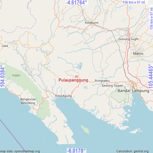
Pulaupanggung GPS coordinates[2]
5° 19' 5.232" South, 104° 44' 29.472" East
| Map corner | latitude | longitude |
|---|---|---|
| Upper-left | -4.61764°, | 104.0384° |
| Center: | -5.31812°, | 104.74152° |
| Lower-right: | -6.0178°, | 105.44465° |
| Map W x H: | 155.7×155.7 km | = 96.7×96.7mi |
| max Lat: | 5.88969° ⇑11.6% North |
| Pulaupanggung: | -5.31812° |
| min Lat: | ⇓88.4% South -10.934° |
| min Long | Pulaupanggung | max Long |
| 95.1345° | 104.74152° | 140.9419° |
| W 5.3%⇐ | ⇒94.7% E |
Elevation
Elevation of Pulaupanggung is 304 m = 997 ft, and this is 74.3 m = 244 ft above average elevation for this country.
| Max E: |
3185 m = 10449 ft | 29.1% |
| Pulaupanggung | 304 m 997 ft | |
| Avg. | 229.7 m = 754 ft | |
Min E: |
-1 m = -3 ft | 70.9% |
See also: Indonesia elevation on elevation.city.
Geographical zone
Pulaupanggung is located in South Torrid zone (between Equator and Tropic of Capricorn). Distance of Equator is 591.3 km =367.4 mi to North.| Distance of | km | miles | from Pulaupanggung |
|---|---|---|---|
| Equator | 591.3 | 367.4 | to North |
| Tropic Capricorn | 2014.6 | 1251.8 | to South |
| Antarctic Circle | 6809.9 | 4231.5 | to South |
| South Pole | 9415.7 | 5850.6 | to South |


Nearby cities:
15 places around Pulaupanggung: (largest is in red/bold)
• Bangunrejo
38.2 km =23.7 mi,  58°
58°
• Bukitkemuning
54.3 km =33.7 mi,  339°
339°
• Gadingrejo
35.9 km =22.3 mi,  99°
99°
• Gedong Tataan
39.8 km =24.7 mi, 100°
• Kalirejo
26.4 km =16.4 mi,  67°
67°
• Kedaton
57.8 km =35.9 mi, 97°
• Kedondong
32.9 km =20.4 mi,  119°
119°
• Kota Agung
23.1 km =14.4 mi,  207°
207°
• Kotaagung
23.6 km =14.7 mi, 214°
• Kotabumi
57 km =35.4 mi,  15°
15°
• Natar
49.9 km =31 mi,  88°
88°
• Oganlima
50.3 km =31.3 mi,  355°
355°
• Padangcermin
54 km =33.6 mi,  125°
125°
• Pringsewu
26.2 km =16.3 mi, 99°
• Sukoharjo Satu
26.8 km =16.7 mi, 85°
Sources, notices
• [Note1] Compared only with cities in Indonesia existing in our database
• [Src1] Map data: © OpenStreetMap contributors (CC-BY-SA)
• [Src2] Other city data from geonames.org with taken over terms of usage.
• [Src3] Geographical zone / Annual Mean Temperature by Robert A. Rohde @ Wikipedia
