Gadingrejo geodata
Gadingrejo (Lampung) is a seat of a third-order administrative division; located in Indonesia in Asia/Jakarta (GMT+7) time zone. In our database, there are 407 cities with bigger population. Compared to other cities in Indonesia, 88.3% of cities are located further ↓South; 94.5% of cities are located further →East and 53.7% of cities have lower elevation than Gadingrejo. Note1


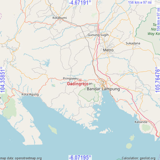
Gadingrejo GPS coordinates[2]
5° 22' 20.388" South, 105° 3' 41.868" East
| Map corner | latitude | longitude |
|---|---|---|
| Upper-left | -4.67191°, | 104.35851° |
| Center: | -5.37233°, | 105.06163° |
| Lower-right: | -6.07195°, | 105.76476° |
| Map W x H: | 155.7×155.7 km | = 96.7×96.7mi |
| max Lat: | 5.88969° ⇑11.7% North |
| Gadingrejo: | -5.37233° |
| min Lat: | ⇓88.3% South -10.934° |
| min Long | Gadingrejo | max Long |
| 95.1345° | 105.06163° | 140.9419° |
| W 5.5%⇐ | ⇒94.5% E |
Elevation
Elevation of Gadingrejo is 118 m = 387 ft, and this is 111.7 m = 366 ft below average elevation for this country.
| Max E: |
3185 m = 10449 ft | 46.3% |
| Avg. | 229.7 m = 754 ft | |
| Gadingrejo | 118 m = 387 ft | |
Min E: |
-1 m = -3 ft | 53.7% |
See also: Indonesia elevation on elevation.city.
Geographical zone
Gadingrejo is located in South Torrid zone (between Equator and Tropic of Capricorn). Distance of Equator is 597.3 km =371.1 mi to North.| Distance of | km | miles | from Gadingrejo |
|---|---|---|---|
| Equator | 597.3 | 371.1 | to North |
| Tropic Capricorn | 2008.6 | 1248.1 | to South |
| Antarctic Circle | 6803.8 | 4227.7 | to South |
| South Pole | 9409.7 | 5846.9 | to South |


Nearby cities:
15 places around Gadingrejo: (largest is in red/bold)
• Bandar Lampung
23 km =14.3 mi,  105°
105°
• Bangunrejo
25.9 km =16.1 mi,  354°
354°
• Batanghari
43.2 km =26.8 mi,  53°
53°
• Gedong Tataan
3.9 km =2.4 mi, 107°
• Kalirejo
19.7 km =12.2 mi,  325°
325°
• Kedaton
22 km =13.7 mi,  93°
93°
• Kedondong
12.1 km =7.5 mi,  213°
213°
• Metro
39.6 km =24.6 mi,  43°
43°
• Natar
16.1 km =10 mi,  64°
64°
• Padangcermin
26.8 km =16.7 mi,  161°
161°
• Panjang
30.8 km =19.1 mi, 111°
• Pringsewu
9.8 km =6.1 mi,  279°
279°
• Pulaupanggung
35.9 km =22.3 mi, 279°
• Punggur
43.9 km =27.3 mi,  32°
32°
• Sukoharjo Satu
11.8 km =7.3 mi,  312°
312°
Sources, notices
• [Note1] Compared only with cities in Indonesia existing in our database
• [Src1] Map data: © OpenStreetMap contributors (CC-BY-SA)
• [Src2] Other city data from geonames.org with taken over terms of usage.
• [Src3] Geographical zone / Annual Mean Temperature by Robert A. Rohde @ Wikipedia
