Kota Agung geodata
Kota Agung (Lampung) is a seat of a second-order administrative division; located in Indonesia in Asia/Jakarta (GMT+7) time zone. In our database, there are 407 cities with bigger population. Compared to other cities in Indonesia, 88.2% of cities are located further ↓South; 94.8% of cities are located further →East and 64.2% of cities have higher elevation than Kota Agung. Note1


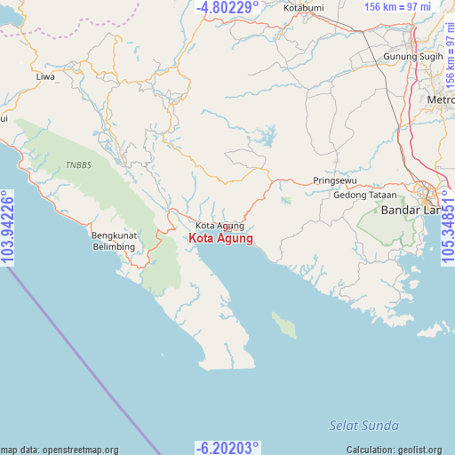
Kota Agung GPS coordinates[2]
5° 30' 9.252" South, 104° 38' 43.368" East
| Map corner | latitude | longitude |
|---|---|---|
| Upper-left | -4.80229°, | 103.94226° |
| Center: | -5.50257°, | 104.64538° |
| Lower-right: | -6.20203°, | 105.34851° |
| Map W x H: | 155.6×155.6 km | = 96.7×96.7mi |
| max Lat: | 5.88969° ⇑11.8% North |
| Kota Agung: | -5.50257° |
| min Lat: | ⇓88.2% South -10.934° |
| min Long | Kota Agung | max Long |
| 95.1345° | 104.64538° | 140.9419° |
| W 5.2%⇐ | ⇒94.8% E |
Elevation
Elevation of Kota Agung is 45 m = 148 ft, and this is 184.7 m = 606 ft below average elevation for this country.
| Max E: |
3185 m = 10449 ft | 64.2% |
| Avg. | 229.7 m = 754 ft | |
| Kota Agung | 45 m = 148 ft | |
Min E: |
-1 m = -3 ft | 35.8% |
See also: Indonesia elevation on elevation.city.
Geographical zone
Kota Agung is located in South Torrid zone (between Equator and Tropic of Capricorn). Distance of Equator is 611.8 km =380.2 mi to North.| Distance of | km | miles | from Kota Agung |
|---|---|---|---|
| Equator | 611.8 | 380.2 | to North |
| Tropic Capricorn | 1994.1 | 1239.1 | to South |
| Antarctic Circle | 6789.3 | 4218.7 | to South |
| South Pole | 9395.2 | 5837.9 | to South |


Nearby cities:
15 places around Kota Agung: (largest is in red/bold)
• Bandar Lampung
68.6 km =42.6 mi,  83°
83°
• Bangunrejo
59.2 km =36.8 mi,  47°
47°
• Biha
70.8 km =44 mi,  285°
285°
• Gadingrejo
48.3 km =30 mi,  72°
72°
• Gedong Tataan
51.6 km =32.1 mi, 75°
• Kalirejo
46.6 km =29 mi, 48°
• Kedaton
69.3 km =43.1 mi, 78°
• Kedondong
39.6 km =24.6 mi, 83°
• Kotaagung
2.8 km =1.7 mi, 289°
• Natar
64.3 km =40 mi, 70°
• Oganlima
70.9 km =44.1 mi,  5°
5°
• Padangcermin
55.7 km =34.6 mi,  101°
101°
• Pringsewu
39.8 km =24.7 mi, 66°
• Pulaupanggung
23.1 km =14.4 mi,  27°
27°
• Sukoharjo Satu
43.6 km =27.1 mi,  59°
59°
Sources, notices
• [Note1] Compared only with cities in Indonesia existing in our database
• [Src1] Map data: © OpenStreetMap contributors (CC-BY-SA)
• [Src2] Other city data from geonames.org with taken over terms of usage.
• [Src3] Geographical zone / Annual Mean Temperature by Robert A. Rohde @ Wikipedia
