Ciduren geodata
Ciduren (West Java) is a seat of a fourth-order administrative division; located in Indonesia in Asia/Jakarta (GMT+7) time zone. In our database, there are 407 cities with bigger population. Compared to other cities in Indonesia, 55.5% of cities are located further ↓South; 85.1% of cities are located further →East and 84.7% of cities have lower elevation than Ciduren. Note1


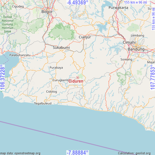
Ciduren GPS coordinates[2]
7° 11' 30.48" South, 107° 4' 31.44" East
| Map corner | latitude | longitude |
|---|---|---|
| Upper-left | -6.49369°, | 106.37228° |
| Center: | -7.1918°, | 107.0754° |
| Lower-right: | -7.88884°, | 107.77853° |
| Map W x H: | 155.1×155.1 km | = 96.4×96.4mi |
| max Lat: | 5.88969° ⇑44.5% North |
| Ciduren: | -7.1918° |
| min Lat: | ⇓55.5% South -10.934° |
| min Long | Ciduren | max Long |
| 95.1345° | 107.0754° | 140.9419° |
| W 14.9%⇐ | ⇒85.1% E |
Elevation
Elevation of Ciduren is 511 m = 1677 ft, and this is 281.3 m = 923 ft above average elevation for this country.
| Max E: |
3185 m = 10449 ft | 15.3% |
| Ciduren | 511 m 1677 ft | |
| Avg. | 229.7 m = 754 ft | |
Min E: |
-1 m = -3 ft | 84.7% |
See also: Indonesia elevation on elevation.city.
Geographical zone
Ciduren is located in South Torrid zone (between Equator and Tropic of Capricorn). Distance of Equator is 799.7 km =496.9 mi to North.| Distance of | km | miles | from Ciduren |
|---|---|---|---|
| Equator | 799.7 | 496.9 | to North |
| Tropic Capricorn | 1806.3 | 1122.4 | to South |
| Antarctic Circle | 6601.5 | 4102 | to South |
| South Pole | 9207.4 | 5721.2 | to South |


Nearby cities:
15 places around Ciduren: (largest is in red/bold)
• Babakantugu
7.5 km =4.7 mi,  171°
171°
• Cimanggu
7.9 km =4.9 mi,  221°
221°
• Cintasari
5.8 km =3.6 mi,  229°
229°
• Cisasak
5.4 km =3.4 mi,  91°
91°
• Gintungsari
6.1 km =3.8 mi,  314°
314°
• Gunungwaru Satu
6.2 km =3.9 mi,  207°
207°
• Kampungtengah
5.4 km =3.4 mi,  8°
8°
• Kebonkaret
5.6 km =3.5 mi,  184°
184°
• Legokbuluh
6.4 km =4 mi,  126°
126°
• Parabon
7.4 km =4.6 mi,  36°
36°
• Selagedang Dua
3.9 km =2.4 mi,  80°
80°
• Sukamulya
3.1 km =1.9 mi, 77°
• Sukasari
2.3 km =1.4 mi,  270°
270°
• Tugu
7.9 km =4.9 mi,  196°
196°
• Warungawi
5.4 km =3.4 mi, 271°
Sources, notices
• [Note1] Compared only with cities in Indonesia existing in our database
• [Src1] Map data: © OpenStreetMap contributors (CC-BY-SA)
• [Src2] Other city data from geonames.org with taken over terms of usage.
• [Src3] Geographical zone / Annual Mean Temperature by Robert A. Rohde @ Wikipedia
