Kota Ternate geodata
Kota Ternate (Maluku) is a seat of a second-order administrative division; located in Indonesia in Asia/Jayapura (GMT+9) time zone. In our database, there are 407 cities with bigger population. Compared to other cities in Indonesia, 95.9% of cities are located further ↓South; 98.3% of cities are located further ←West and 59.4% of cities have lower elevation than Kota Ternate. Note1


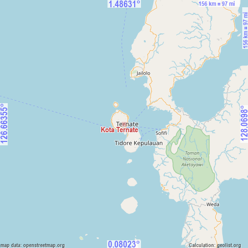
Kota Ternate GPS coordinates[2]
0° 46' 59.988" North, 127° 22' 0.012" East
| Map corner | latitude | longitude |
|---|---|---|
| Upper-left | 1.48631°, | 126.66355° |
| Center: | 0.78333°, | 127.36667° |
| Lower-right: | 0.08023°, | 128.0698° |
| Map W x H: | 156.3×156.3 km | = 97.1×97.1mi |
| max Lat: | 5.88969° ⇑4.1% North |
| Kota Ternate: | 0.78333° |
| min Lat: | ⇓95.9% South -10.934° |
| min Long | Kota Ternate | max Long |
| 95.1345° | 127.36667° | 140.9419° |
| W 98.3%⇐ | ⇒1.7% E |
Elevation
Elevation of Kota Ternate is 157 m = 515 ft, and this is 72.7 m = 239 ft below average elevation for this country.
| Max E: |
3185 m = 10449 ft | 40.6% |
| Avg. | 229.7 m = 754 ft | |
| Kota Ternate | 157 m = 515 ft | |
Min E: |
-1 m = -3 ft | 59.4% |
See also: Indonesia elevation on elevation.city.
Geographical zone
Kota Ternate is located in North Torrid zone (between Equator and Tropic of Cancer). Distance of Equator is 87.1 km =54.1 mi to South.| Distance of | km | miles | from Kota Ternate |
|---|---|---|---|
| North Pole | 9920 | 6164 | to North |
| Arctic Circle | 7314.1 | 4544.8 | to North |
| Tropic Cancer | 2518.8 | 1565.1 | to North |
| Equator | 87.1 | 54.1 | to South |


Nearby cities:
15 places around Kota Ternate: (largest is in red/bold)
• Basiong
1.5 km =0.9 mi,  141°
141°
• Buli
103.3 km =64.2 mi,  96°
96°
• Guruafin
76.2 km =47.3 mi,  174°
174°
• Jailolo
33.3 km =20.7 mi,  19°
19°
• Jambula
6.1 km =3.8 mi,  242°
242°
• Maba
103.3 km =64.2 mi, 95°
• Mafa
100.5 km =62.4 mi, 144°
• Malifud
47.1 km =29.3 mi, 172°
• Sofifi
22 km =13.7 mi, 103°
• Subaim
93.1 km =57.8 mi,  66°
66°
• Susupu
41.6 km =25.8 mi,  10°
10°
• Ternate
2.1 km =1.3 mi, 67°
• Tobelo
127.1 km =79 mi,  34°
34°
• Tongutisungi
82.2 km =51.1 mi, 14°
• Weda
75.7 km =47 mi,  131°
131°
Sources, notices
• [Note1] Compared only with cities in Indonesia existing in our database
• [Src1] Map data: © OpenStreetMap contributors (CC-BY-SA)
• [Src2] Other city data from geonames.org with taken over terms of usage.
• [Src3] Geographical zone / Annual Mean Temperature by Robert A. Rohde @ Wikipedia
