Deranitan geodata
Deranitan (East Nusa Tenggara) is a seat of a fourth-order administrative division; located in Indonesia in Asia/Makassar (GMT+8) time zone. In our database, there are 407 cities with bigger population. Compared to other cities in Indonesia, 99.9% of cities are located further ↑North; 90.3% of cities are located further ←West and 81.9% of cities have higher elevation than Deranitan. Note1


Deranitan GPS coordinates[2]
10° 51' 41.04" South, 123° 0' 44.64" East
| Map corner | latitude | longitude |
|---|---|---|
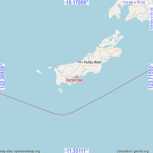
| Upper-left | -10.17009°, | 122.30928° |
| Center: | -10.8614°, | 123.0124° |
| Lower-right: | -11.55111°, | 123.71553° |
| Map W x H: | 153.6×153.6 km | = 95.4×95.4mi |
| max Lat: | 5.88969° ⇑99.9% North |
| Deranitan: | -10.8614° |
| min Lat: | ⇓0.1% South -10.934° |
| min Long | Deranitan | max Long |
| 95.1345° | 123.0124° | 140.9419° |
| W 90.3%⇐ | ⇒9.7% E |
Elevation
Elevation of Deranitan is 17 m = 56 ft, and this is 212.7 m = 698 ft below average elevation for this country.
| Max E: |
3185 m = 10449 ft | 81.9% |
| Avg. | 229.7 m = 754 ft | |
| Deranitan | 17 m = 56 ft | |
Min E: |
-1 m = -3 ft | 18.1% |
See also: Indonesia elevation on elevation.city.
Geographical zone
Deranitan is located in South Torrid zone (between Equator and Tropic of Capricorn). Distance of Equator is 1207.7 km =750.4 mi to North.| Distance of | km | miles | from Deranitan |
|---|---|---|---|
| Equator | 1207.7 | 750.4 | to North |
| Tropic Capricorn | 1398.2 | 868.8 | to South |
| Antarctic Circle | 6193.5 | 3848.5 | to South |
| South Pole | 8799.4 | 5467.7 | to South |


Nearby cities:
15 places around Deranitan: (largest is in red/bold)
• Batutua
3.1 km =1.9 mi,  274°
274°
• Batutua Satu
3.2 km =2 mi, 270°
• Busalangga
6.5 km =4 mi,  351°
351°
• Gayabaru
5.4 km =3.4 mi,  68°
68°
• Inggudale
2 km =1.2 mi,  313°
313°
• Laes
2.6 km =1.6 mi,  39°
39°
• Lalukoen Dua
9.4 km =5.8 mi, 268°
• Modosinal
9.2 km =5.7 mi,  323°
323°
• Nggalai Barat
3.7 km =2.3 mi,  13°
13°
• Oebaffok Satu
6.1 km =3.8 mi,  328°
328°
• Oebatu
5.2 km =3.2 mi,  0°
0°
• Oebou
8.7 km =5.4 mi,  241°
241°
• Oehandi Utara
6.4 km =4 mi,  279°
279°
• Roioen
6.8 km =4.2 mi,  286°
286°
• Souktuanan
9.2 km =5.7 mi,  56°
56°
Sources, notices
• [Note1] Compared only with cities in Indonesia existing in our database
• [Src1] Map data: © OpenStreetMap contributors (CC-BY-SA)
• [Src2] Other city data from geonames.org with taken over terms of usage.
• [Src3] Geographical zone / Annual Mean Temperature by Robert A. Rohde @ Wikipedia
