Gayabaru geodata
Gayabaru (East Nusa Tenggara) is a seat of a fourth-order administrative division; located in Indonesia in Asia/Makassar (GMT+8) time zone. In our database, there are 407 cities with bigger population. Compared to other cities in Indonesia, 99.8% of cities are located further ↑North; 90.5% of cities are located further ←West and 78.9% of cities have higher elevation than Gayabaru. Note1


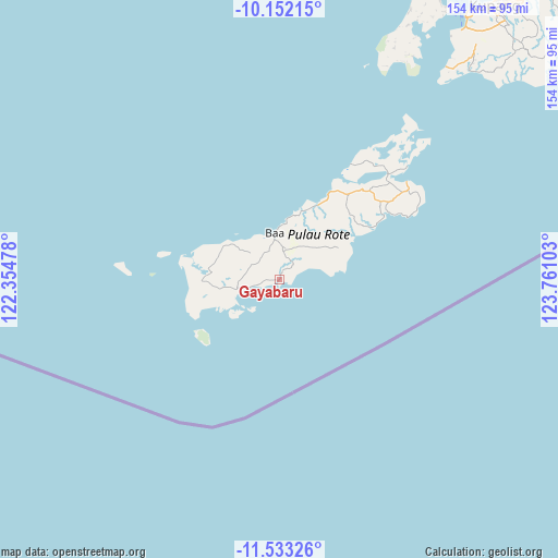
Gayabaru GPS coordinates[2]
10° 50' 36.6" South, 123° 3' 28.44" East
| Map corner | latitude | longitude |
|---|---|---|
| Upper-left | -10.15215°, | 122.35478° |
| Center: | -10.8435°, | 123.0579° |
| Lower-right: | -11.53326°, | 123.76103° |
| Map W x H: | 153.6×153.6 km | = 95.4×95.4mi |
| max Lat: | 5.88969° ⇑99.8% North |
| Gayabaru: | -10.8435° |
| min Lat: | ⇓0.2% South -10.934° |
| min Long | Gayabaru | max Long |
| 95.1345° | 123.0579° | 140.9419° |
| W 90.5%⇐ | ⇒9.5% E |
Elevation
Elevation of Gayabaru is 20 m = 66 ft, and this is 209.7 m = 688 ft below average elevation for this country.
| Max E: |
3185 m = 10449 ft | 78.9% |
| Avg. | 229.7 m = 754 ft | |
| Gayabaru | 20 m = 66 ft | |
Min E: |
-1 m = -3 ft | 21.1% |
See also: Indonesia elevation on elevation.city.
Geographical zone
Gayabaru is located in South Torrid zone (between Equator and Tropic of Capricorn). Distance of Equator is 1205.7 km =749.2 mi to North.| Distance of | km | miles | from Gayabaru |
|---|---|---|---|
| Equator | 1205.7 | 749.2 | to North |
| Tropic Capricorn | 1400.2 | 870 | to South |
| Antarctic Circle | 6195.5 | 3849.7 | to South |
| South Pole | 8801.4 | 5468.9 | to South |


Nearby cities:
15 places around Gayabaru: (largest is in red/bold)
• Asamboka
8.3 km =5.2 mi,  340°
340°
• Batutua
8.2 km =5.1 mi,  257°
257°
• Batutua Satu
8.4 km =5.2 mi, 256°
• Busalangga
7.4 km =4.6 mi,  306°
306°
• Deranitan
5.4 km =3.4 mi,  248°
248°
• Inggudale
6.5 km =4 mi, 264°
• Kolobolon
9.6 km =6 mi,  61°
61°
• Laes
3.3 km =2.1 mi,  270°
270°
• Lekik
9.1 km =5.7 mi,  30°
30°
• Nggalai Barat
4.4 km =2.7 mi,  290°
290°
• Oebaffok Satu
8.8 km =5.5 mi, 291°
• Oebatu
5.9 km =3.7 mi,  303°
303°
• Oemaulain
10.5 km =6.5 mi, 344°
• Sanggaoen
8.8 km =5.5 mi,  349°
349°
• Souktuanan
4.1 km =2.5 mi,  42°
42°
Sources, notices
• [Note1] Compared only with cities in Indonesia existing in our database
• [Src1] Map data: © OpenStreetMap contributors (CC-BY-SA)
• [Src2] Other city data from geonames.org with taken over terms of usage.
• [Src3] Geographical zone / Annual Mean Temperature by Robert A. Rohde @ Wikipedia
