Muke geodata
Muke (East Nusa Tenggara) is a seat of a fourth-order administrative division; located in Indonesia in Asia/Makassar (GMT+8) time zone. In our database, there are 407 cities with bigger population. Compared to other cities in Indonesia, 97.4% of cities are located further ↑North; 94.6% of cities are located further ←West and 74.9% of cities have lower elevation than Muke. Note1


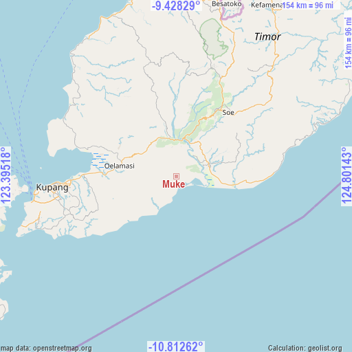
Muke GPS coordinates[2]
10° 7' 16.32" South, 124° 5' 53.88" East
| Map corner | latitude | longitude |
|---|---|---|
| Upper-left | -9.42829°, | 123.39518° |
| Center: | -10.1212°, | 124.0983° |
| Lower-right: | -10.81262°, | 124.80143° |
| Map W x H: | 153.9×153.9 km | = 95.6×95.6mi |
| max Lat: | 5.88969° ⇑97.4% North |
| Muke: | -10.1212° |
| min Lat: | ⇓2.6% South -10.934° |
| min Long | Muke | max Long |
| 95.1345° | 124.0983° | 140.9419° |
| W 94.6%⇐ | ⇒5.4% E |
Elevation
Elevation of Muke is 358 m = 1175 ft, and this is 128.3 m = 421 ft above average elevation for this country.
| Max E: |
3185 m = 10449 ft | 25.1% |
| Muke | 358 m 1175 ft | |
| Avg. | 229.7 m = 754 ft | |
Min E: |
-1 m = -3 ft | 74.9% |
See also: Indonesia elevation on elevation.city.
Geographical zone
Muke is located in South Torrid zone (between Equator and Tropic of Capricorn). Distance of Equator is 1125.4 km =699.3 mi to North.| Distance of | km | miles | from Muke |
|---|---|---|---|
| Equator | 1125.4 | 699.3 | to North |
| Tropic Capricorn | 1480.5 | 919.9 | to South |
| Antarctic Circle | 6275.8 | 3899.6 | to South |
| South Pole | 8881.7 | 5518.8 | to South |


Nearby cities:
15 places around Muke: (largest is in red/bold)
• Aeka
7.9 km =4.9 mi,  61°
61°
• Bikoen
9.7 km =6 mi,  86°
86°
• Boitimu
15.8 km =9.8 mi,  222°
222°
• Fuskou
14.9 km =9.3 mi,  228°
228°
• Oehaunu
7.9 km =4.9 mi,  25°
25°
• Oekero
6.5 km =4 mi, 234°
• Oemofa
4.1 km =2.5 mi, 26°
• Oenuntono
4.5 km =2.8 mi,  315°
315°
• Oetaman
12.3 km =7.6 mi,  46°
46°
• Panite
15.3 km =9.5 mi,  68°
68°
• Polo
15.7 km =9.8 mi, 66°
• Toifeu
14.8 km =9.2 mi,  77°
77°
• Tubunaen
16.5 km =10.3 mi,  15°
15°
• Tubunain
15.7 km =9.8 mi,  7°
7°
• Tunmunih
15.1 km =9.4 mi,  303°
303°
Sources, notices
• [Note1] Compared only with cities in Indonesia existing in our database
• [Src1] Map data: © OpenStreetMap contributors (CC-BY-SA)
• [Src2] Other city data from geonames.org with taken over terms of usage.
• [Src3] Geographical zone / Annual Mean Temperature by Robert A. Rohde @ Wikipedia
