Oefatu geodata
Oefatu (East Nusa Tenggara) is a seat of a fourth-order administrative division; located in Indonesia in Asia/Makassar (GMT+8) time zone. In our database, there are 407 cities with bigger population. Compared to other cities in Indonesia, 95.9% of cities are located further ↑North; 95.9% of cities are located further ←West and 92.4% of cities have lower elevation than Oefatu. Note1


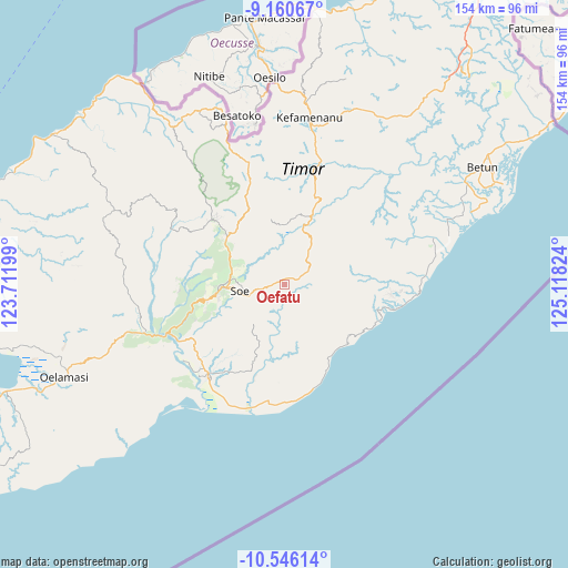
Oefatu GPS coordinates[2]
9° 51' 14.868" South, 124° 24' 54.396" East
| Map corner | latitude | longitude |
|---|---|---|
| Upper-left | -9.16067°, | 123.71199° |
| Center: | -9.85413°, | 124.41511° |
| Lower-right: | -10.54614°, | 125.11824° |
| Map W x H: | 154×154.1 km | = 95.7×95.8mi |
| max Lat: | 5.88969° ⇑95.9% North |
| Oefatu: | -9.85413° |
| min Lat: | ⇓4.1% South -10.934° |
| min Long | Oefatu | max Long |
| 95.1345° | 124.41511° | 140.9419° |
| W 95.9%⇐ | ⇒4.1% E |
Elevation
Elevation of Oefatu is 720 m = 2362 ft, and this is 490.3 m = 1609 ft above average elevation for this country.
| Max E: |
3185 m = 10449 ft | 7.6% |
| Oefatu | 720 m 2362 ft | |
| Avg. | 229.7 m = 754 ft | |
Min E: |
-1 m = -3 ft | 92.4% |
See also: Indonesia elevation on elevation.city.
Geographical zone
Oefatu is located in South Torrid zone (between Equator and Tropic of Capricorn). Distance of Equator is 1095.7 km =680.8 mi to North.| Distance of | km | miles | from Oefatu |
|---|---|---|---|
| Equator | 1095.7 | 680.8 | to North |
| Tropic Capricorn | 1510.2 | 938.4 | to South |
| Antarctic Circle | 6305.5 | 3918.1 | to South |
| South Pole | 8911.4 | 5537.3 | to South |


Nearby cities:
15 places around Oefatu: (largest is in red/bold)
• Bone
7 km =4.3 mi,  49°
49°
• Hoi
4.8 km =3 mi,  25°
25°
• Kusi
5.9 km =3.7 mi,  259°
259°
• Mio
8.1 km =5 mi,  280°
280°
• Naukae
3.7 km =2.3 mi, 28°
• Neonmat
9.4 km =5.8 mi, 255°
• Neto
2.3 km =1.4 mi, 280°
• Nikiniki
8.1 km =5 mi,  56°
56°
• Nobinobi
5.2 km =3.2 mi,  66°
66°
• Noebesa
5.4 km =3.4 mi,  93°
93°
• Oepula
8.9 km =5.5 mi, 256°
• Polo Satu
9.4 km =5.8 mi,  315°
315°
• Supul
3.6 km =2.2 mi, 72°
• Tetaf
2.8 km =1.7 mi,  43°
43°
• Tumu
8.2 km =5.1 mi, 92°
Sources, notices
• [Note1] Compared only with cities in Indonesia existing in our database
• [Src1] Map data: © OpenStreetMap contributors (CC-BY-SA)
• [Src2] Other city data from geonames.org with taken over terms of usage.
• [Src3] Geographical zone / Annual Mean Temperature by Robert A. Rohde @ Wikipedia
