Noebesa geodata
Noebesa (East Nusa Tenggara) is a seat of a fourth-order administrative division; located in Indonesia in Asia/Makassar (GMT+8) time zone. In our database, there are 407 cities with bigger population. Compared to other cities in Indonesia, 95.9% of cities are located further ↑North; 96.2% of cities are located further ←West and 87.8% of cities have lower elevation than Noebesa. Note1


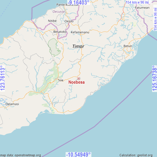
Noebesa GPS coordinates[2]
9° 51' 26.964" South, 124° 27' 51.3" East
| Map corner | latitude | longitude |
|---|---|---|
| Upper-left | -9.16403°, | 123.76113° |
| Center: | -9.85749°, | 124.46425° |
| Lower-right: | -10.54949°, | 125.16738° |
| Map W x H: | 154×154.1 km | = 95.7×95.8mi |
| max Lat: | 5.88969° ⇑95.9% North |
| Noebesa: | -9.85749° |
| min Lat: | ⇓4.1% South -10.934° |
| min Long | Noebesa | max Long |
| 95.1345° | 124.46425° | 140.9419° |
| W 96.2%⇐ | ⇒3.8% E |
Elevation
Elevation of Noebesa is 578 m = 1896 ft, and this is 348.3 m = 1143 ft above average elevation for this country.
| Max E: |
3185 m = 10449 ft | 12.2% |
| Noebesa | 578 m 1896 ft | |
| Avg. | 229.7 m = 754 ft | |
Min E: |
-1 m = -3 ft | 87.8% |
See also: Indonesia elevation on elevation.city.
Geographical zone
Noebesa is located in South Torrid zone (between Equator and Tropic of Capricorn). Distance of Equator is 1096.1 km =681.1 mi to North.| Distance of | km | miles | from Noebesa |
|---|---|---|---|
| Equator | 1096.1 | 681.1 | to North |
| Tropic Capricorn | 1509.9 | 938.2 | to South |
| Antarctic Circle | 6305.1 | 3917.8 | to South |
| South Pole | 8911 | 5537 | to South |


Nearby cities:
15 places around Noebesa: (largest is in red/bold)
• Baki
8.1 km =5 mi,  172°
172°
• Bone
4.9 km =3 mi,  359°
359°
• Fatubia
6.6 km =4.1 mi,  51°
51°
• Feuknoni
5.8 km =3.6 mi,  81°
81°
• Hoi
5.8 km =3.6 mi,  324°
324°
• Naukae
5.1 km =3.2 mi, 315°
• Neto
7.7 km =4.8 mi,  275°
275°
• Nikiniki
5.1 km =3.2 mi,  15°
15°
• Nobinobi
2.5 km =1.6 mi,  346°
346°
• Oefatu
5.4 km =3.4 mi,  273°
273°
• Oefau
9.1 km =5.7 mi,  126°
126°
• Supul
2.4 km =1.5 mi,  307°
307°
• Tetaf
4.2 km =2.6 mi, 305°
• Tumu
2.9 km =1.8 mi,  89°
89°
• Tumu
4.9 km =3 mi, 133°
Sources, notices
• [Note1] Compared only with cities in Indonesia existing in our database
• [Src1] Map data: © OpenStreetMap contributors (CC-BY-SA)
• [Src2] Other city data from geonames.org with taken over terms of usage.
• [Src3] Geographical zone / Annual Mean Temperature by Robert A. Rohde @ Wikipedia
