Sopo geodata
Sopo (East Nusa Tenggara) is a seat of a fourth-order administrative division; located in Indonesia in Asia/Makassar (GMT+8) time zone. In our database, there are 407 cities with bigger population. Compared to other cities in Indonesia, 95.3% of cities are located further ↑North; 96.3% of cities are located further ←West and 84.8% of cities have lower elevation than Sopo. Note1


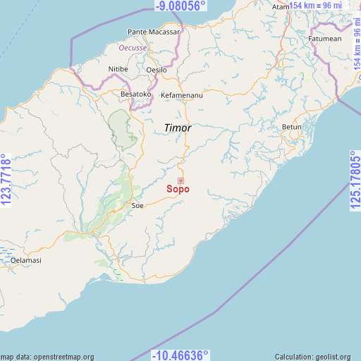
Sopo GPS coordinates[2]
9° 46' 27.048" South, 124° 28' 29.712" East
| Map corner | latitude | longitude |
|---|---|---|
| Upper-left | -9.08056°, | 123.7718° |
| Center: | -9.77418°, | 124.47492° |
| Lower-right: | -10.46636°, | 125.17805° |
| Map W x H: | 154.1×154.1 km | = 95.8×95.8mi |
| max Lat: | 5.88969° ⇑95.3% North |
| Sopo: | -9.77418° |
| min Lat: | ⇓4.7% South -10.934° |
| min Long | Sopo | max Long |
| 95.1345° | 124.47492° | 140.9419° |
| W 96.3%⇐ | ⇒3.7% E |
Elevation
Elevation of Sopo is 513 m = 1683 ft, and this is 283.3 m = 929 ft above average elevation for this country.
| Max E: |
3185 m = 10449 ft | 15.2% |
| Sopo | 513 m 1683 ft | |
| Avg. | 229.7 m = 754 ft | |
Min E: |
-1 m = -3 ft | 84.8% |
See also: Indonesia elevation on elevation.city.
Geographical zone
Sopo is located in South Torrid zone (between Equator and Tropic of Capricorn). Distance of Equator is 1086.8 km =675.3 mi to North.| Distance of | km | miles | from Sopo |
|---|---|---|---|
| Equator | 1086.8 | 675.3 | to North |
| Tropic Capricorn | 1519.1 | 943.9 | to South |
| Antarctic Circle | 6314.4 | 3923.6 | to South |
| South Pole | 8920.3 | 5542.8 | to South |


Nearby cities:
15 places around Sopo: (largest is in red/bold)
• Bileon
6.8 km =4.2 mi,  100°
100°
• Bone
4.5 km =2.8 mi,  195°
195°
• Fatubia
6.5 km =4 mi,  142°
142°
• Hoi
6.4 km =4 mi,  224°
224°
• Melahue
7.5 km =4.7 mi,  289°
289°
• Naukae
7.4 km =4.6 mi, 220°
• Neosob
1.7 km =1.1 mi,  25°
25°
• Nikiniki
4.4 km =2.7 mi,  177°
177°
• Nobinobi
7 km =4.3 mi,  194°
194°
• Noebesa
9.3 km =5.8 mi, 187°
• Oeoh
4.3 km =2.7 mi,  15°
15°
• Pili
3.4 km =2.1 mi, 95°
• Supul
8.4 km =5.2 mi, 201°
• Tetaf
8.3 km =5.2 mi,  214°
214°
• Tumu
9.4 km =5.8 mi,  169°
169°
Sources, notices
• [Note1] Compared only with cities in Indonesia existing in our database
• [Src1] Map data: © OpenStreetMap contributors (CC-BY-SA)
• [Src2] Other city data from geonames.org with taken over terms of usage.
• [Src3] Geographical zone / Annual Mean Temperature by Robert A. Rohde @ Wikipedia
