Oeleon geodata
Oeleon (East Nusa Tenggara) is a seat of a fourth-order administrative division; located in Indonesia in Asia/Makassar (GMT+8) time zone. In our database, there are 407 cities with bigger population. Compared to other cities in Indonesia, 95.4% of cities are located further ↑North; 96.9% of cities are located further ←West and 94.9% of cities have lower elevation than Oeleon. Note1


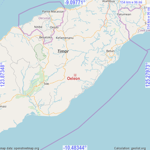
Oeleon GPS coordinates[2]
9° 47' 28.68" South, 124° 34' 35.76" East
| Map corner | latitude | longitude |
|---|---|---|
| Upper-left | -9.09771°, | 123.87348° |
| Center: | -9.7913°, | 124.5766° |
| Lower-right: | -10.48344°, | 125.27973° |
| Map W x H: | 154.1×154.1 km | = 95.8×95.8mi |
| max Lat: | 5.88969° ⇑95.4% North |
| Oeleon: | -9.7913° |
| min Lat: | ⇓4.6% South -10.934° |
| min Long | Oeleon | max Long |
| 95.1345° | 124.5766° | 140.9419° |
| W 96.9%⇐ | ⇒3.1% E |
Elevation
Elevation of Oeleon is 815 m = 2674 ft, and this is 585.3 m = 1920 ft above average elevation for this country.
| Max E: |
3185 m = 10449 ft | 5.1% |
| Oeleon | 815 m 2674 ft | |
| Avg. | 229.7 m = 754 ft | |
Min E: |
-1 m = -3 ft | 94.9% |
See also: Indonesia elevation on elevation.city.
Geographical zone
Oeleon is located in South Torrid zone (between Equator and Tropic of Capricorn). Distance of Equator is 1088.7 km =676.5 mi to North.| Distance of | km | miles | from Oeleon |
|---|---|---|---|
| Equator | 1088.7 | 676.5 | to North |
| Tropic Capricorn | 1517.2 | 942.7 | to South |
| Antarctic Circle | 6312.5 | 3922.4 | to South |
| South Pole | 8918.4 | 5541.6 | to South |


Nearby cities:
15 places around Oeleon: (largest is in red/bold)
• Anin
5.7 km =3.5 mi,  177°
177°
• Bileon
4.5 km =2.8 mi,  278°
278°
• Fatubia
7.9 km =4.9 mi,  245°
245°
• Fatuhilik
3.3 km =2.1 mi,  114°
114°
• Kie
6.7 km =4.2 mi,  207°
207°
• Kolo
5.3 km =3.3 mi,  7°
7°
• Linakelopu
3.4 km =2.1 mi,  120°
120°
• Oebubun
8 km =5 mi,  160°
160°
• Oenpeotnai
6.8 km =4.2 mi,  185°
185°
• Oinlasi
6.5 km =4 mi, 182°
• Pili
7.9 km =4.9 mi, 281°
• Pisan
6.5 km =4 mi,  20°
20°
• Sunu
7.7 km =4.8 mi, 113°
• Tene
8.1 km =5 mi,  132°
132°
• Tunis
4.7 km =2.9 mi,  42°
42°
Sources, notices
• [Note1] Compared only with cities in Indonesia existing in our database
• [Src1] Map data: © OpenStreetMap contributors (CC-BY-SA)
• [Src2] Other city data from geonames.org with taken over terms of usage.
• [Src3] Geographical zone / Annual Mean Temperature by Robert A. Rohde @ Wikipedia
