Oenpeotnai geodata
Oenpeotnai (East Nusa Tenggara) is a seat of a fourth-order administrative division; located in Indonesia in Asia/Makassar (GMT+8) time zone. In our database, there are 407 cities with bigger population. Compared to other cities in Indonesia, 95.8% of cities are located further ↑North; 96.9% of cities are located further ←West and 96.6% of cities have lower elevation than Oenpeotnai. Note1


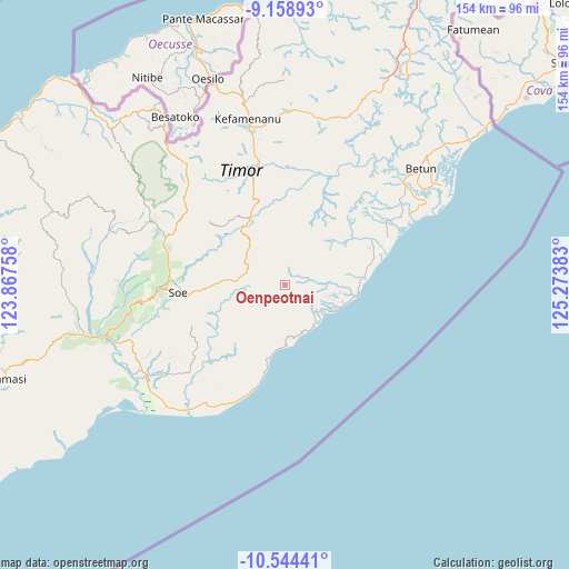
Oenpeotnai GPS coordinates[2]
9° 51' 8.64" South, 124° 34' 14.52" East
| Map corner | latitude | longitude |
|---|---|---|
| Upper-left | -9.15893°, | 123.86758° |
| Center: | -9.8524°, | 124.5707° |
| Lower-right: | -10.54441°, | 125.27383° |
| Map W x H: | 154.1×154.1 km | = 95.8×95.8mi |
| max Lat: | 5.88969° ⇑95.8% North |
| Oenpeotnai: | -9.8524° |
| min Lat: | ⇓4.2% South -10.934° |
| min Long | Oenpeotnai | max Long |
| 95.1345° | 124.5707° | 140.9419° |
| W 96.9%⇐ | ⇒3.1% E |
Elevation
Elevation of Oenpeotnai is 922 m = 3025 ft, and this is 692.3 m = 2271 ft above average elevation for this country.
| Max E: |
3185 m = 10449 ft | 3.4% |
| Oenpeotnai | 922 m 3025 ft | |
| Avg. | 229.7 m = 754 ft | |
Min E: |
-1 m = -3 ft | 96.6% |
See also: Indonesia elevation on elevation.city.
Geographical zone
Oenpeotnai is located in South Torrid zone (between Equator and Tropic of Capricorn). Distance of Equator is 1095.5 km =680.7 mi to North.| Distance of | km | miles | from Oenpeotnai |
|---|---|---|---|
| Equator | 1095.5 | 680.7 | to North |
| Tropic Capricorn | 1510.4 | 938.5 | to South |
| Antarctic Circle | 6305.7 | 3918.2 | to South |
| South Pole | 8911.6 | 5537.4 | to South |


Nearby cities:
15 places around Oenpeotnai: (largest is in red/bold)
• Anin
1.4 km =0.9 mi,  41°
41°
• Ayofanu
3.4 km =2.1 mi,  139°
139°
• Fatubia
7.4 km =4.6 mi,  298°
298°
• Fatuhilik
6.5 km =4 mi,  34°
34°
• Fatuulan
7.7 km =4.8 mi, 142°
• Feuknoni
6 km =3.7 mi,  272°
272°
• Kie
2.6 km =1.6 mi,  288°
288°
• Linakelopu
6.2 km =3.9 mi, 34°
• Nunleu
6.6 km =4.1 mi,  117°
117°
• Oebubun
3.4 km =2.1 mi,  101°
101°
• Oefau
7.4 km =4.6 mi,  215°
215°
• Oeleon
6.8 km =4.2 mi,  5°
5°
• Oinlasi
0.5 km =0.3 mi,  55°
55°
• Poto
5.9 km =3.7 mi,  173°
173°
• Tene
6.7 km =4.2 mi,  78°
78°
Sources, notices
• [Note1] Compared only with cities in Indonesia existing in our database
• [Src1] Map data: © OpenStreetMap contributors (CC-BY-SA)
• [Src2] Other city data from geonames.org with taken over terms of usage.
• [Src3] Geographical zone / Annual Mean Temperature by Robert A. Rohde @ Wikipedia
