Tanahedang geodata
Tanahedang (East Nusa Tenggara) is a seat of a fourth-order administrative division; located in Indonesia in Asia/Makassar (GMT+8) time zone. In our database, there are 407 cities with bigger population. Compared to other cities in Indonesia, 85.4% of cities are located further ↑North; 89.7% of cities are located further ←West and 56.3% of cities have lower elevation than Tanahedang. Note1


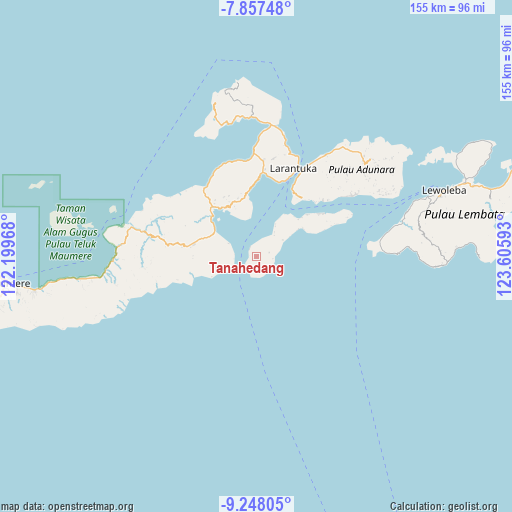
Tanahedang GPS coordinates[2]
8° 33' 12.24" South, 122° 54' 10.08" East
| Map corner | latitude | longitude |
|---|---|---|
| Upper-left | -7.85748°, | 122.19968° |
| Center: | -8.5534°, | 122.9028° |
| Lower-right: | -9.24805°, | 123.60593° |
| Map W x H: | 154.6×154.6 km | = 96.1×96.1mi |
| max Lat: | 5.88969° ⇑85.4% North |
| Tanahedang: | -8.5534° |
| min Lat: | ⇓14.6% South -10.934° |
| min Long | Tanahedang | max Long |
| 95.1345° | 122.9028° | 140.9419° |
| W 89.7%⇐ | ⇒10.3% E |
Elevation
Elevation of Tanahedang is 132 m = 433 ft, and this is 97.7 m = 321 ft below average elevation for this country.
| Max E: |
3185 m = 10449 ft | 43.7% |
| Avg. | 229.7 m = 754 ft | |
| Tanahedang | 132 m = 433 ft | |
Min E: |
-1 m = -3 ft | 56.3% |
See also: Indonesia elevation on elevation.city.
Geographical zone
Tanahedang is located in South Torrid zone (between Equator and Tropic of Capricorn). Distance of Equator is 951 km =590.9 mi to North.| Distance of | km | miles | from Tanahedang |
|---|---|---|---|
| Equator | 951 | 590.9 | to North |
| Tropic Capricorn | 1654.9 | 1028.3 | to South |
| Antarctic Circle | 6450.1 | 4007.9 | to South |
| South Pole | 9056 | 5627.1 | to South |


Nearby cities:
15 places around Tanahedang: (largest is in red/bold)
• Daniwato
9 km =5.6 mi,  36°
36°
• Haridimun
12.8 km =8 mi,  57°
57°
• Kalelu
4 km =2.5 mi,  71°
71°
• Lamagohang
14.9 km =9.3 mi, 56°
• Lamalewo
13.3 km =8.3 mi,  29°
29°
• Lewohokeng
3.8 km =2.4 mi,  200°
200°
• Lewotobi
7.8 km =4.8 mi,  251°
251°
• Nobo
14.6 km =9.1 mi,  301°
301°
• Nurabelen
9.4 km =5.8 mi, 295°
• Riangbaring
14.8 km =9.2 mi, 246°
• Riangkaha
6.7 km =4.2 mi,  276°
276°
• Rianglaka
10.8 km =6.7 mi, 32°
• Ritaebang
3.3 km =2.1 mi,  319°
319°
• Ritaebang Satu
3.5 km =2.2 mi,  326°
326°
• Sulengwaseng
9.5 km =5.9 mi, 57°
Sources, notices
• [Note1] Compared only with cities in Indonesia existing in our database
• [Src1] Map data: © OpenStreetMap contributors (CC-BY-SA)
• [Src2] Other city data from geonames.org with taken over terms of usage.
• [Src3] Geographical zone / Annual Mean Temperature by Robert A. Rohde @ Wikipedia
