Pemana geodata
Pemana (East Nusa Tenggara) is a seat of a fourth-order administrative division; located in Indonesia in Asia/Makassar (GMT+8) time zone. In our database, there are 407 cities with bigger population. Compared to other cities in Indonesia, 78.8% of cities are located further ↑North; 88.8% of cities are located further ←West and 90.6% of cities have higher elevation than Pemana. Note1


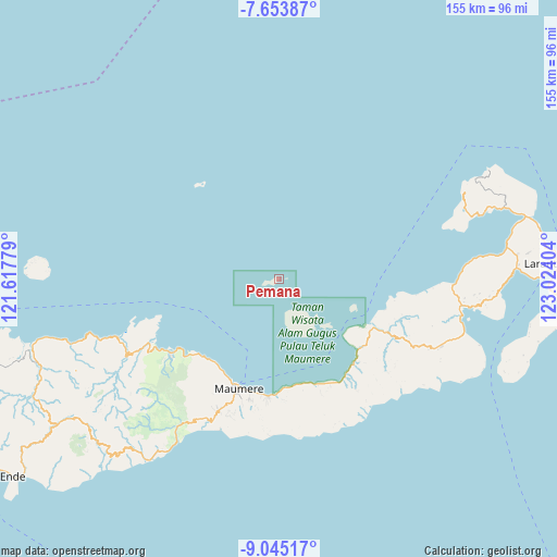
Pemana GPS coordinates[2]
8° 21' 0.504" South, 122° 19' 15.276" East
| Map corner | latitude | longitude |
|---|---|---|
| Upper-left | -7.65387°, | 121.61779° |
| Center: | -8.35014°, | 122.32091° |
| Lower-right: | -9.04517°, | 123.02404° |
| Map W x H: | 154.7×154.7 km | = 96.1×96.1mi |
| max Lat: | 5.88969° ⇑78.8% North |
| Pemana: | -8.35014° |
| min Lat: | ⇓21.2% South -10.934° |
| min Long | Pemana | max Long |
| 95.1345° | 122.32091° | 140.9419° |
| W 88.8%⇐ | ⇒11.2% E |
Elevation
Elevation of Pemana is 10 m = 33 ft, and this is 219.7 m = 721 ft below average elevation for this country.
| Max E: |
3185 m = 10449 ft | 90.6% |
| Avg. | 229.7 m = 754 ft | |
| Pemana | 10 m = 33 ft | |
Min E: |
-1 m = -3 ft | 9.4% |
See also: Indonesia elevation on elevation.city.
Geographical zone
Pemana is located in South Torrid zone (between Equator and Tropic of Capricorn). Distance of Equator is 928.4 km =576.9 mi to North.| Distance of | km | miles | from Pemana |
|---|---|---|---|
| Equator | 928.4 | 576.9 | to North |
| Tropic Capricorn | 1677.5 | 1042.3 | to South |
| Antarctic Circle | 6472.7 | 4021.9 | to South |
| South Pole | 9078.6 | 5641.2 | to South |


Nearby cities:
15 places around Pemana: (largest is in red/bold)
• Koja Besar
17.4 km =10.8 mi,  152°
152°
• Kotauneng
31.7 km =19.7 mi,  201°
201°
• Nangahale
30.9 km =19.2 mi,  138°
138°
• Nangahaledoi
31.4 km =19.5 mi,  180°
180°
• Nangahure
29.8 km =18.5 mi,  214°
214°
• Nangahurebukitpermai
29.7 km =18.5 mi,  216°
216°
• Natargran
31.3 km =19.4 mi,  159°
159°
• Natarleba
30.3 km =18.8 mi,  126°
126°
• Nebe
29.8 km =18.5 mi,  117°
117°
• Parumaan
17.8 km =11.1 mi, 130°
• Talibura
29.7 km =18.5 mi, 130°
• Urungpigang
31.7 km =19.7 mi, 207°
• Waigete
31.2 km =19.4 mi, 159°
• Waipare
32.3 km =20.1 mi,  188°
188°
• Wolomarang
31.2 km =19.4 mi, 205°
Sources, notices
• [Note1] Compared only with cities in Indonesia existing in our database
• [Src1] Map data: © OpenStreetMap contributors (CC-BY-SA)
• [Src2] Other city data from geonames.org with taken over terms of usage.
• [Src3] Geographical zone / Annual Mean Temperature by Robert A. Rohde @ Wikipedia
