Koja Besar geodata
Koja Besar (East Nusa Tenggara) is a seat of a fourth-order administrative division; located in Indonesia in Asia/Makassar (GMT+8) time zone. In our database, there are 407 cities with bigger population. Compared to other cities in Indonesia, 82.9% of cities are located further ↑North; 88.9% of cities are located further ←West and 85.2% of cities have higher elevation than Koja Besar. Note1


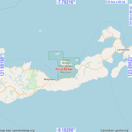
Koja Besar GPS coordinates[2]
8° 29' 17.52" South, 122° 23' 42.36" East
| Map corner | latitude | longitude |
|---|---|---|
| Upper-left | -7.79216°, | 121.69198° |
| Center: | -8.4882°, | 122.3951° |
| Lower-right: | -9.18298°, | 123.09823° |
| Map W x H: | 154.6×154.6 km | = 96.1×96.1mi |
| max Lat: | 5.88969° ⇑82.9% North |
| Koja Besar: | -8.4882° |
| min Lat: | ⇓17.1% South -10.934° |
| min Long | Koja Besar | max Long |
| 95.1345° | 122.3951° | 140.9419° |
| W 88.9%⇐ | ⇒11.1% E |
Elevation
Elevation of Koja Besar is 14 m = 46 ft, and this is 215.7 m = 708 ft below average elevation for this country.
| Max E: |
3185 m = 10449 ft | 85.2% |
| Avg. | 229.7 m = 754 ft | |
| Koja Besar | 14 m = 46 ft | |
Min E: |
-1 m = -3 ft | 14.8% |
See also: Indonesia elevation on elevation.city.
Geographical zone
Koja Besar is located in South Torrid zone (between Equator and Tropic of Capricorn). Distance of Equator is 943.8 km =586.4 mi to North.| Distance of | km | miles | from Koja Besar |
|---|---|---|---|
| Equator | 943.8 | 586.4 | to North |
| Tropic Capricorn | 1662.1 | 1032.8 | to South |
| Antarctic Circle | 6457.4 | 4012.4 | to South |
| South Pole | 9063.3 | 5631.7 | to South |


Nearby cities:
15 places around Koja Besar: (largest is in red/bold)
• Aibura
21.1 km =13.1 mi,  199°
199°
• Ewa
19.5 km =12.1 mi,  140°
140°
• Higetegera
22 km =13.7 mi,  217°
217°
• Kawapante
20.7 km =12.9 mi,  211°
211°
• Kloangrotat
22.2 km =13.8 mi, 197°
• Nangahale
14.6 km =9.1 mi,  122°
122°
• Nangahaledoi
18.1 km =11.2 mi, 207°
• Natargran
14.2 km =8.8 mi,  168°
168°
• Natarleba
16.3 km =10.1 mi,  100°
100°
• Nebe
18.4 km =11.4 mi,  85°
85°
• Parumaan
6.5 km =4 mi,  54°
54°
• Pemana
17.4 km =10.8 mi,  332°
332°
• Talibura
14.9 km =9.3 mi,  105°
105°
• Waigete
14.1 km =8.8 mi, 168°
• Waipare
21 km =13 mi, 217°
Sources, notices
• [Note1] Compared only with cities in Indonesia existing in our database
• [Src1] Map data: © OpenStreetMap contributors (CC-BY-SA)
• [Src2] Other city data from geonames.org with taken over terms of usage.
• [Src3] Geographical zone / Annual Mean Temperature by Robert A. Rohde @ Wikipedia
