Bidihunggar geodata
Bidihunggar (East Nusa Tenggara) is a seat of a fourth-order administrative division; located in Indonesia in Asia/Makassar (GMT+8) time zone. In our database, there are 407 cities with bigger population. Compared to other cities in Indonesia, 92.7% of cities are located further ↑North; 82.7% of cities are located further ←West and 92.1% of cities have higher elevation than Bidihunggar. Note1


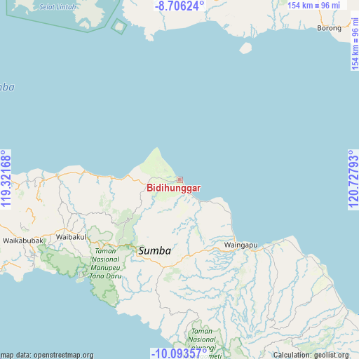
Bidihunggar GPS coordinates[2]
9° 24' 2.16" South, 120° 1' 29.28" East
| Map corner | latitude | longitude |
|---|---|---|
| Upper-left | -8.70624°, | 119.32168° |
| Center: | -9.4006°, | 120.0248° |
| Lower-right: | -10.09357°, | 120.72793° |
| Map W x H: | 154.3×154.3 km | = 95.9×95.9mi |
| max Lat: | 5.88969° ⇑92.7% North |
| Bidihunggar: | -9.4006° |
| min Lat: | ⇓7.3% South -10.934° |
| min Long | Bidihunggar | max Long |
| 95.1345° | 120.0248° | 140.9419° |
| W 82.7%⇐ | ⇒17.3% E |
Elevation
Elevation of Bidihunggar is 9 m = 30 ft, and this is 220.7 m = 724 ft below average elevation for this country.
| Max E: |
3185 m = 10449 ft | 92.1% |
| Avg. | 229.7 m = 754 ft | |
| Bidihunggar | 9 m = 30 ft | |
Min E: |
-1 m = -3 ft | 7.9% |
See also: Indonesia elevation on elevation.city.
Geographical zone
Bidihunggar is located in South Torrid zone (between Equator and Tropic of Capricorn). Distance of Equator is 1045.2 km =649.5 mi to North.| Distance of | km | miles | from Bidihunggar |
|---|---|---|---|
| Equator | 1045.2 | 649.5 | to North |
| Tropic Capricorn | 1560.7 | 969.8 | to South |
| Antarctic Circle | 6355.9 | 3949.4 | to South |
| South Pole | 8961.8 | 5568.6 | to South |


Nearby cities:
15 places around Bidihunggar: (largest is in red/bold)
• Alanga
33.5 km =20.8 mi,  242°
242°
• Kambatatamakawu
14.5 km =9 mi,  260°
260°
• Kapunduk
6 km =3.7 mi,  154°
154°
• Karipidita
34.8 km =21.6 mi,  179°
179°
• Kowingir
7 km =4.3 mi,  156°
156°
• Landa
30.5 km =19 mi,  134°
134°
• Lokuuy
29.5 km =18.3 mi,  231°
231°
• Matumadua
29.8 km =18.5 mi,  272°
272°
• Napu
10.8 km =6.7 mi, 272°
• Ngarangiakambera
30.1 km =18.7 mi, 184°
• Pahomba
35 km =21.7 mi,  224°
224°
• Rambangaru
6.3 km =3.9 mi, 151°
• Retijawa
12.9 km =8 mi,  139°
139°
• Tambulatana
22.7 km =14.1 mi,  123°
123°
• Wairinding
32.5 km =20.2 mi, 159°
Sources, notices
• [Note1] Compared only with cities in Indonesia existing in our database
• [Src1] Map data: © OpenStreetMap contributors (CC-BY-SA)
• [Src2] Other city data from geonames.org with taken over terms of usage.
• [Src3] Geographical zone / Annual Mean Temperature by Robert A. Rohde @ Wikipedia
