Lampuuk geodata
Lampuuk (Aceh) is a seat of a third-order administrative division; located in Indonesia in Asia/Jakarta (GMT+7) time zone. In our database, there are 407 cities with bigger population. Compared to other cities in Indonesia, 100% of cities are located further ↓South; 99.9% of cities are located further →East and 97.2% of cities have higher elevation than Lampuuk. Note1


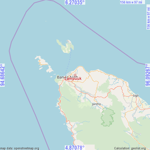
Lampuuk GPS coordinates[2]
5° 34' 15.528" North, 95° 23' 22.344" East
| Map corner | latitude | longitude |
|---|---|---|
| Upper-left | 6.27035°, | 94.68642° |
| Center: | 5.57098°, | 95.38954° |
| Lower-right: | 4.87078°, | 96.09267° |
| Map W x H: | 155.6×155.6 km | = 96.7×96.7mi |
| max Lat: | 5.88969° ⇑0% North |
| Lampuuk: | 5.57098° |
| min Lat: | ⇓100% South -10.934° |
| min Long | Lampuuk | max Long |
| 95.1345° | 95.38954° | 140.9419° |
| W 0.1%⇐ | ⇒99.9% E |
Elevation
Elevation of Lampuuk is 6 m = 20 ft, and this is 223.7 m = 734 ft below average elevation for this country.
| Max E: |
3185 m = 10449 ft | 97.2% |
| Avg. | 229.7 m = 754 ft | |
| Lampuuk | 6 m = 20 ft | |
Min E: |
-1 m = -3 ft | 2.8% |
See also: Indonesia elevation on elevation.city.
Geographical zone
Lampuuk is located in North Torrid zone (between Equator and Tropic of Cancer). Distance of Equator is 619.4 km =384.9 mi to South.| Distance of | km | miles | from Lampuuk |
|---|---|---|---|
| North Pole | 9387.6 | 5833.2 | to North |
| Arctic Circle | 6781.7 | 4214 | to North |
| Tropic Cancer | 1986.5 | 1234.4 | to North |
| Equator | 619.4 | 384.9 | to South |


Nearby cities:
15 places around Lampuuk: (largest is in red/bold)
• Angan
3.9 km =2.4 mi,  3°
3°
• Banda Aceh
7 km =4.3 mi,  242°
242°
• Indrapuri
10.9 km =6.8 mi,  163°
163°
• Kruengraya
14 km =8.7 mi,  81°
81°
• Lambaro
5.3 km =3.3 mi,  251°
251°
• Lampuyang
30.3 km =18.8 mi,  291°
291°
• Lhoknga
19.1 km =11.9 mi, 236°
• Lhoong
37.2 km =23.1 mi,  204°
204°
• Luthu
28.7 km =17.8 mi,  177°
177°
• Mata Ie
7.7 km =4.8 mi,  231°
231°
• Montasik
8.5 km =5.3 mi,  153°
153°
• Peukanbada
18.3 km =11.4 mi,  257°
257°
• Sabang
36.3 km =22.6 mi,  347°
347°
• Seulimeum
31.1 km =19.3 mi,  138°
138°
• Sibreh
6.1 km =3.8 mi, 197°
Sources, notices
• [Note1] Compared only with cities in Indonesia existing in our database
• [Src1] Map data: © OpenStreetMap contributors (CC-BY-SA)
• [Src2] Other city data from geonames.org with taken over terms of usage.
• [Src3] Geographical zone / Annual Mean Temperature by Robert A. Rohde @ Wikipedia
