Lampuyang geodata
Lampuyang (Aceh) is a seat of a third-order administrative division; located in Indonesia in Asia/Jakarta (GMT+7) time zone. In our database, there are 407 cities with bigger population. Compared to other cities in Indonesia, 100% of cities are located further ↓South; 100% of cities are located further →East and 89% of cities have higher elevation than Lampuyang. Note1


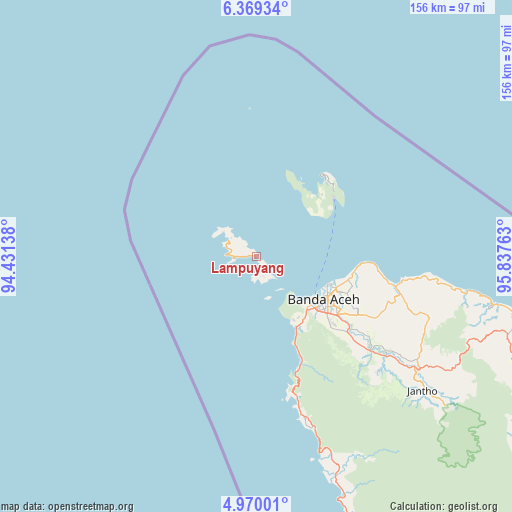
Lampuyang GPS coordinates[2]
5° 40' 12.36" North, 95° 8' 4.2" East
| Map corner | latitude | longitude |
|---|---|---|
| Upper-left | 6.36934°, | 94.43138° |
| Center: | 5.6701°, | 95.1345° |
| Lower-right: | 4.97001°, | 95.83763° |
| Map W x H: | 155.6×155.6 km | = 96.7×96.7mi |
| max Lat: | 5.88969° ⇑0% North |
| Lampuyang: | 5.6701° |
| min Lat: | ⇓100% South -10.934° |
| min Long | Lampuyang | max Long |
| 95.1345° | 95.1345° | 140.9419° |
| W 0%⇐ | ⇒100% E |
Elevation
Elevation of Lampuyang is 11 m = 36 ft, and this is 218.7 m = 718 ft below average elevation for this country.
| Max E: |
3185 m = 10449 ft | 89% |
| Avg. | 229.7 m = 754 ft | |
| Lampuyang | 11 m = 36 ft | |
Min E: |
-1 m = -3 ft | 11% |
See also: Indonesia elevation on elevation.city.
Geographical zone
Lampuyang is located in North Torrid zone (between Equator and Tropic of Cancer). Distance of Equator is 630.5 km =391.8 mi to South.| Distance of | km | miles | from Lampuyang |
|---|---|---|---|
| North Pole | 9376.6 | 5826.3 | to North |
| Arctic Circle | 6770.7 | 4207.1 | to North |
| Tropic Cancer | 1975.5 | 1227.5 | to North |
| Equator | 630.5 | 391.8 | to South |


Nearby cities:
15 places around Lampuyang: (largest is in red/bold)
• Angan
29.3 km =18.2 mi,  104°
104°
• Banda Aceh
26.2 km =16.3 mi,  122°
122°
• Indrapuri
38 km =23.6 mi, 124°
• Kruengraya
43 km =26.7 mi, 102°
• Lambaro
26.4 km =16.4 mi, 118°
• Lampuuk
30.3 km =18.8 mi,  111°
111°
• Lhoknga
24.7 km =15.3 mi,  150°
150°
• Lhoong
46.6 km =29 mi,  164°
164°
• Luthu
49.5 km =30.8 mi,  143°
143°
• Mata Ie
27.2 km =16.9 mi,  125°
125°
• Montasik
37 km =23 mi, 120°
• Peukanbada
18.2 km =11.3 mi, 145°
• Sabang
31.6 km =19.6 mi,  39°
39°
• Seulimeum
59.7 km =37.1 mi, 125°
• Sibreh
31.3 km =19.4 mi, 122°
Sources, notices
• [Note1] Compared only with cities in Indonesia existing in our database
• [Src1] Map data: © OpenStreetMap contributors (CC-BY-SA)
• [Src2] Other city data from geonames.org with taken over terms of usage.
• [Src3] Geographical zone / Annual Mean Temperature by Robert A. Rohde @ Wikipedia
